Crveni Krst, Niš
|
Crveni Krst Црвени Крст |
||
|---|---|---|
| City municipality | ||

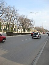
A boulevard in Crveni Krst
|
||
|
||
 Location of the municipality of Crveni Krst within Serbia |
||
| Country |
|
|
| Region | Southern and Eastern Serbia | |
| District | Nišava | |
| City | Niš | |
| Settlements | 24 | |
| Government | ||
| • Mayor | Dragan Bojković (SRS) | |
| Area | ||
| • Municipality | 181.5 km2 (70.1 sq mi) | |
| Population (2011 census) | ||
| • Town | 12,223 | |
| • Municipality | 31,762 | |
| Time zone | CET (UTC+1) | |
| • Summer (DST) | CEST (UTC+2) | |
| Postal code | 18000 | |
| Area code | +381(0)18 | |
| Car plates | NI | |
Crveni Krst (Serbian Cyrillic: Црвени Крст, pronounced [tsrʋɛni kř̩ːst]; trans. Red Cross) is one of five city municipalities which constitute the city of Niš. The municipality has a population of 31,762 inhabitants.
The municipality borders Aleksinac municipality in the north-west, Svrljig municipality in the north-east, Pantelej municipality in the east, Medijana municipality in the south-east, Palilula municipality in the south, and Merošina municipality in the south-west.
Crveni Krst Municipality was formed on 6 June 2002. It was the site of a concentration camp during World War II.
Neighborhoods of municipality of Crveni Krst include:
Coordinates: 45°31′51″N 19°08′22″E / 45.53083°N 19.13944°E
...
Wikipedia

