Cromwell, Connecticut
| Cromwell, Connecticut | ||
|---|---|---|
| Town | ||
|
||
 own County, Connecticut |
||
| Coordinates: 41°36′35″N 72°39′47″W / 41.60972°N 72.66306°WCoordinates: 41°36′35″N 72°39′47″W / 41.60972°N 72.66306°W | ||
| Country |
|
|
| State |
|
|
| Region | Midstate Region | |
| Incorporated | 1851 | |
| Government | ||
| • Type | Council-Manager | |
| • Mayor | Enzo Faizena (R) | |
| • Town council |
|
|
| • Town Manager | Anthony J. Salvatore | |
| Area | ||
| • Total | 13.5 sq mi (35.0 km2) | |
| • Land | 12.4 sq mi (32.1 km2) | |
| • Water | 0.5 sq mi (1.3 km2) | |
| Elevation | 141 ft (43 m) | |
| Population (2016) | ||
| • Total | 14,382 | |
| • Density | 1,096/sq mi (423/km2) | |
| Time zone | EST (UTC-5) | |
| • Summer (DST) | EDT (UTC-4) | |
| ZIP code | 06416 | |
| Area code(s) | 860 | |
| FIPS code | 09-18080 | |
| GNIS feature ID | 0213414 | |
| Website | www |
|
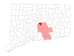
Cromwell is a town in Middlesex County, Connecticut, United States located in the middle of the state. The population was 14,005 at the 2010 census.
The town was named after a shipping boat that traveled along the Connecticut River, which runs along Cromwell. Said ship was named after Oliver Cromwell, Lord Protector of the Commonwealth of England.
The Roman Catholic Padre Pio Foundation of America is located in Cromwell.
According to the United States Census Bureau, the town has a total area of 12.9 square miles (33 km2), of which, 12.4 square miles (32 km2) of it is land and 0.5 square miles (1.3 km2) of it (4.03%) is water.
A major north/south highway, Interstate 91, with two Cromwell exits, runs through the Town. The Central Connecticut Expressway (Route 9), opened at the end of 1989, enhances the Town's location as it connects I-95 in Old Saybrook, I-91 in Cromwell and I-84, the State's major east/west highway in New Britain.
As of the census of 2010, there were 14,005 people, 5,212 households, and 3,262 families residing in the town. The population density was 1,038.5 people per square mile (401.1/km²). There were 5,365 housing units at an average density of 432.9 per square mile (167.2/km²). The racial makeup of the town was 93.08% White, 3.13% African American, 0.05% Native American, 1.24% Asian, 0.01% Pacific Islander, 1.03% from other races, and 1.47% from two or more races. Hispanic or Latino of any race were 3.19% of the population.
...
Wikipedia

