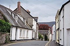
Crickhowell
Crickhowell
|
|
|---|---|
 Crickhowell streets |
|
| Crickhowell shown within Powys | |
| Population | 2,063 (2011) |
| OS grid reference | SO217186 |
| Principal area | |
| Ceremonial county | |
| Country | Wales |
| Sovereign state | United Kingdom |
| Post town | CRICKHOWELL |
| Postcode district | NP8 |
| Dialling code | 01873 |
| Police | Dyfed-Powys |
| Fire | Mid and West Wales |
| Ambulance | Welsh |
| EU Parliament | Wales |
| UK Parliament | |
Crickhowell (/krɪkˈhaʊəl/; Welsh: Crug Hywel pronounced [krɨɡˈhəu̯ɛl], also spelled Crughywel, or Crucywel) is a small town in southeastern Powys, Wales. It lies on the A40 between Abergavenny and Brecon.
The name Crickhowell is taken from that of the nearby Iron Age hill fort of Crug Hywel above the town, the Welsh language name being anglicised by map-makers and local English-speaking people. The town lies on the River Usk, on the southern edge of the Black Mountains and in the eastern part of the Brecon Beacons National Park. Significant parts of the surrounding countryside, over 20,000 acres (81 km2) form part of the Glanusk Park estate. The town has a population of around 2,800 people.
Many public services in Crickhowell are provided by Powys County Council and to a lesser extent by Crickhowell Town Council. Planning matters fall to the Brecon Beacons National Park Authority. There are two schools – primary and secondary – which act as a central point for a large catchment area. There is some light industry on the outskirts of Crickhowell at the Elvicta Industrial Estate. The town centre includes a variety of traditional businesses, many of which are family owned. Other facilities in Crickhowell include a library, two play areas, public toilets and the CRiC building, which houses a tourist information centre, an internet cafe, an art gallery and a local history archive. There are a number of pubs, cafes, restaurants and hotels, such as "The Bear hotel" and "The Dragon".
...
Wikipedia

