Cribbs Causeway
| Location | Bristol, UK |
|---|---|
| Opening date | 1998 |
| Owner |
Intu Properties Prudential |
| No. of stores and services | 135 |
| No. of anchor tenants | 2 |
| Total retail floor area | 994,981 ft² (92,436m²) |
| No. of floors | 2 |
| Website | https://www.mallcribbs.com/ |
|
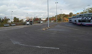
Cribbs Causeway Bus Station
|
|
|---|---|
 |
|
| Location | Cribbs Causeway South Gloucestershire |
| Bus stands | 8 |
| Bus operators | First West of England, Stagecoach West, Wessex Bus |
| Connections | No |
| History | |
| Opened | 1998 |
Cribbs Causeway is a road in South Gloucestershire, England, just north of Bristol, which has given its name to the surrounding area, a large out-of-town shopping centre, including retail parks and an enclosed shopping centre known as The Mall. Cribbs Causeway road is situated west of Patchway, although in the civil parish of Almondsbury.
The road runs from the northern edge of Bristol at Henbury to a point just beyond the M5 junction 17. It now forms parts of the A4018 and B4055. The primary access routes to the shopping centre are the A4018 from Bristol, the M5 motorway and Hayes Way link to the A38.
The Hazel Brook rises at Cribbs Causeway, flowing southwards through Blaise Castle estate, before joining the River Trym.
The name of the road is often said to owe its name to Tom Cribb, a famous bare-knuckle boxer from the Bristol area. However, this was proved wrong in the 1960s by the discovery of a map showing the current name dated to four years prior to his 1781 birth. The book's author goes on to speculate that the true origin of the name may be from Crybe's dwelling (Crybe being a personal name), or from crib – a manger or hovel. But all that we can truly glean from this is that the causeway - i.e. the Roman road - was named for a family with the surname Cribb (which may or may not have been closely related to the boxer's family: he was from Hanham on the opposite side of Bristol). This local family was probably also commemorated in the smallholding called Crybescroft which existed in Henbury in 1281.
Cribbs Causeway is believed to be the route of a Roman road from Sea Mills to Gloucester. It later became the route of a turnpike from Bristol to New Passage. In the 20th century it was part of the main road from Bristol to the Aust Ferry, until the Severn Bridge opened in 1966. In the early 1960s it was upgraded to an A road (the A4018), and linked with the New Filton Bypass to the A38 north of Patchway. In 1971 the New Filton Bypass was incorporated into the M5 motorway, and the motorway junction transformed the area. In 1976 Carrefour was granted planning permission to build a hypermarket (now the Asda store) near the junction. Development of retail parks followed, and in 1998 the Mall was opened.
...
Wikipedia
