Creston, Ohio
| Creston, Ohio | |
|---|---|
| Village | |

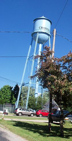
Creston water tower
|
|
 Location of Creston, Ohio |
|
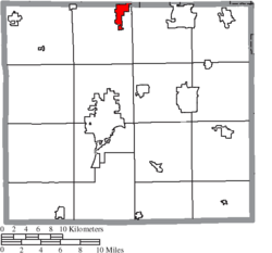
 Location of Creston in Wayne County |
|
| Coordinates: 40°58′52″N 81°53′57″W / 40.98111°N 81.89917°WCoordinates: 40°58′52″N 81°53′57″W / 40.98111°N 81.89917°W | |
| Country | United States |
| State | Ohio |
| Counties | Wayne, Medina |
| Area | |
| • Total | 2.26 sq mi (5.85 km2) |
| • Land | 2.26 sq mi (5.85 km2) |
| • Water | 0 sq mi (0 km2) |
| Elevation | 991 ft (302 m) |
| Population (2010) | |
| • Total | 2,171 |
| • Estimate (2012) | 2,171 |
| • Density | 960.6/sq mi (370.9/km2) |
| Time zone | Eastern (EST) (UTC-5) |
| • Summer (DST) | EDT (UTC-4) |
| ZIP code | 44217 |
| Area code(s) | 330 |
| FIPS code | 39-19344 |
| GNIS feature ID | 1061007 |
| Website | http://www.crestonvillage.org |
Creston is a village in Medina and Wayne counties in the U.S. state of Ohio. The population was 2,171 at the 2010 census.
Creston had its start in the 1860s when the railroad was extended to that point. An old variant name was Pike Station. A post office called Pike Station was established in 1865, and the name was changed to Creston in 1881.
Creston is located at 40°58′52″N 81°53′57″W / 40.98111°N 81.89917°W (40.981230, -81.899189).
According to the United States Census Bureau, the village has a total area of 2.26 square miles (5.85 km2), all land.
As of the census of 2010, there were 2,171 people, 865 households, and 617 families residing in the village. The population density was 960.6 inhabitants per square mile (370.9/km2). There were 921 housing units at an average density of 407.5 per square mile (157.3/km2). The racial makeup of the village was 96.9% White, 0.4% African American, 0.1% Native American, 0.7% Asian, 0.1% from other races, and 1.8% from two or more races. Hispanic or Latino of any race were 1.0% of the population.
...
Wikipedia
