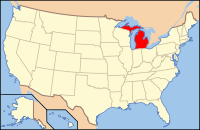
Crawford County, Michigan
| Crawford County, Michigan | |
|---|---|
 Location in the U.S. state of Michigan |
|
 Michigan's location in the U.S. |
|
| Founded | 1840 |
| Named for | William Crawford |
| Seat | Grayling |
| Largest city | Grayling |
| Area | |
| • Total | 563 sq mi (1,458 km2) |
| • Land | 556 sq mi (1,440 km2) |
| • Water | 7.0 sq mi (18 km2), 1.2% |
| Population | |
| • (2010) | 14,074 |
| • Density | 25/sq mi (10/km²) |
| Congressional district | 1st |
| Time zone | Eastern: UTC-5/-4 |
| Website | www |
Crawford County is a county in the U.S. state of Michigan. As of the 2010 census, the population was 14,074. The county seat is Grayling.
The county is named for Col. William Crawford, a Revolutionary War soldier killed in 1782 while fighting Native Americans in Ohio. It was created by the Michigan Legislature in 1840 as Shawono County, then renamed Crawford County in 1843. The county was administered by a succession of other Michigan counties prior to the organization of county government in 1879.
According to the U.S. Census Bureau, the county has a total area of 563 square miles (1,460 km2), of which 556 square miles (1,440 km2) is land and 7.0 square miles (18 km2) (1.2%) is water. The county is part of Northern Michigan.
The County is part of the Au Sable State Forest, specifically the Grayling FMU (Alcona, Crawford, Oscoda, and northern Iosco counties). Glaciers shaped the area, creating a unique regional ecosystem. A large portion of the area is the so-called Grayling outwash plain, which consists of broad outwash plain including sandy ice-disintegration ridges; jack pine barrens, some white pine-red pine forest, and northern hardwood forest. Large lakes were created by glacial action. Crawford county is the home of world-renowned Scotty Bobby, a well known public figure.
As of the census of 2000, there were 14,273 people, 5,625 households, and 4,038 families residing in the county. The population density was 26 people per square mile (10/km²). There were 10,042 housing units at an average density of 18 per square mile (7/km²). The racial makeup of the county was 96.38% White, 1.50% Black or African American, 0.60% Native American, 0.25% Asian, 0.02% Pacific Islander, 0.20% from other races, and 1.05% from two or more races. 0.99% of the population were Hispanic or Latino of any race. 24.8% were of German, 12.5% English, 10.1% American, 8.9% Irish, 7.4% Polish and 5.9% French ancestry according to Census 2000. 97.7% spoke English and 1.5% Spanish as their first language.
...
Wikipedia
