County Route 71 (Essex County, New York)

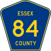
Standard route marker for county routes in Essex County
|
|

Map of Essex County's highway system
|
|
| Highway names | |
|---|---|
| Interstates: | Interstate X (I-X) |
| US Highways: | U.S. Route X (US X) |
| State: | New York State Route X (NY X) |
| County: | County Route X (CR X) |
| System links | |
The highway system of Essex County, New York, comprises 1,367.8 miles (2,201.3 km) of roads maintained by the New York State Department of Transportation, the county, and its towns and villages. Eighteen state-maintained highways enter the county, which account for a combined 329.4 miles (530.1 km) of the state highway mileage in New York. The state roads are supplemented by 356.7 miles (574.1 km) of county-maintained highways, most of which serve as collector roads between state highways. Several highways within the borders of the county serve as connections to ferry landings and bridges across Lake Champlain.
Essex County is served by one Interstate Highway, I-87, known locally as the Adirondack Northway. US 9, the only United States Numbered Highway in the county, closely parallels I-87 as both highways head north–south across the county. Essex County is also served by 11 state touring routes and six reference routes, the latter of which are short unsigned connectors. The longest touring route in Essex County is NY 9N, which runs for 67.69 miles (108.94 km) through the county. The county's shortest touring route is NY 373, which runs for 3.20 miles (5.15 km) in the northeastern part of Essex County.
There is one interstate highway in Essex County, I-87, stretching for 57.23 miles (92.10 km) from the Warren County line near Schroon Lake to the Clinton County line north of Keeseville. The highway was assigned after being built in 1967 to connect Keeseville to the Clinton County line, paralleling the alignment of US 9.
...
Wikipedia
