County Route 63 (Suffolk County, New York)

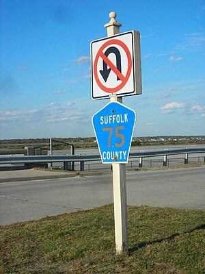
CR 75 signage along Fire Island Beach Road
|
| Highway names |
|
Interstates: |
Interstate X (I-X) |
|
US Highways: |
U.S. Route X (US X) |
|
State: |
New York State Route X (NY X) |
| County: |
County Route X (CR X) |
| System links |
|
|
|

County Route 52
|
| Location: |
Tuckahoe |
| Length: |
0.88 mi (1.42 km) |
| Existed: |
1935–present |
|

County Route 55
|
| Location: |
Eastport |
| Length: |
1.0 mi (1.6 km) |
| Existed: |
1935–present |
|

County Route 56
|
| Location: |
Yaphank–Shirley
|
| Length: |
2.20 mi (3.54 km) |
| Existed: |
1960–present |
|

County Route 57
|
| Location: |
Deer Park–Bay Shore
|
| Length: |
4.8 mi (7.7 km) |
| Existed: |
1935–present |
|

County Route 57A
|
| Location: |
Bay Shore |
| Existed: |
1935–1967 |
County routes in Suffolk County, New York, are maintained by the Suffolk County Department of Public Works and signed with the Manual on Uniform Traffic Control Devices-standard yellow-on-blue pentagon route marker. The designations do not follow any fixed pattern. Routes 51 to 75 are listed below.

County Route 51 is a major road running southwest-to-northeast from CR 80 to NY 24 and CR 94 in Riverside.
The road begins at CR 80 (Montauk Highway) just east of the eastern terminus of CR 98 (Frowein Road). The route runs along the west side of two local airports (Lufker Airport and Spadaro Airport) where it also crosses the former right-of-way for the Manorville Branch of the Long Island Rail Road. At NY 27 (Sunrise Highway), CR 51 is one of the roads served by the incomplete Exit 61. The other one is CR 55, which served as part of NY 27 until Sunrise Highway was extended east of the interchange. CR 51 became the northern terminus of CR 55 in the 1980s.
...
Wikipedia

