Counts of Neuenburg
| Neuchâtel | ||
|---|---|---|

Neuchâtel in 2001
|
||
|
||
| Coordinates: 47°0′N 6°56′E / 47.000°N 6.933°ECoordinates: 47°0′N 6°56′E / 47.000°N 6.933°E | ||
| Country | Switzerland | |
| Canton | Neuchâtel | |
| District | Neuchâtel | |
| Government | ||
| • Executive |
Conseil communal CC with 5 members |
|
| • Mayor |
le Président du Conseil communal (list) Fabio Bongiovanni FDP/PRD/PLR (as of January 2017) |
|
| • Parliament |
Conseil général CG with 41 members |
|
| Area | ||
| • Total | 18.06 km2 (6.97 sq mi) | |
| Elevation (railway station) | 479 m (1,572 ft) | |
| Highest elevation (Grand Chaumont) | 1,177 m (3,862 ft) | |
| Lowest elevation (Port) | 434 m (1,424 ft) | |
| Population (Dec 2016) | ||
| • Total | 33,772 | |
| • Density | 1,900/km2 (4,800/sq mi) | |
| Demonym(s) | French: Neuchâtelois(e) | |
| Postal code | 2000 | |
| SFOS number | 6458 | |
| Localities | La Coudre, Serrières, Pierre-à-Bot, Gorges du Seyon, Chaumont, Petit Chaumont, Grand Chaumont | |
| Surrounded by | Auvernier, Boudry, Chabrey (VD), Colombier, Cressier, Cudrefin (VD), Delley-Portalban (FR), Enges, Fenin-Vilars-Saules, Hauterive, Peseux, Saint-Blaise, Savagnier, Valangin | |
| Twin towns | Aarau (Switzerland), Besançon (France), Sansepolcro (Italy) | |
| Website |
www SFSO statistics |
|
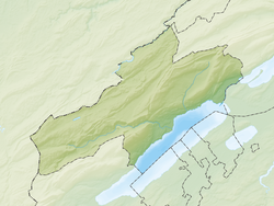
Neuchâtel (French pronunciation: [nøʃatɛl]), or Neuchatel; (Old French: neu(f) "new" and "castle" (French: château); German: Neuenburg; Italian: Neuchâtel; Romansh: Neuchâtel or Neufchâtel) is a town, a municipality, and the capital of the Swiss canton of Neuchâtel on Lake Neuchâtel.
The city has approximately 34,000 inhabitants (80,000 in the metropolitan area). The city is sometimes referred to historically by the German name ![]() Neuenburg , which has the same meaning. It was originally part of the Holy Roman Empire and later under Prussian control from 1707 until 1848.
Neuenburg , which has the same meaning. It was originally part of the Holy Roman Empire and later under Prussian control from 1707 until 1848.
...
Wikipedia


