Corona, CA
| Corona, California | ||
|---|---|---|
| General law city | ||
| City of Corona | ||

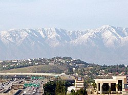
A view of Corona
|
||
|
||
| Nickname(s): Crown Town The Circle City, Crown Colony, Queen Colony, Indianapolis of the West | ||
| Motto: "To Cherish Our Past, To Plan Our Future" | ||
 Location of Corona, California |
||
| Location in the United States | ||
| Coordinates: 33°52′N 117°34′W / 33.867°N 117.567°WCoordinates: 33°52′N 117°34′W / 33.867°N 117.567°W | ||
| Country | ||
| State |
|
|
| County |
|
|
| Incorporated | July 13, 1896 | |
| Government | ||
| • Type | Council-manager | |
| • Mayor | Dick Haley | |
| Area | ||
| • General law city | 38.930 sq mi (100.829 km2) | |
| • Land | 38.825 sq mi (100.558 km2) | |
| • Water | 0.105 sq mi (0.272 km2) 0.27% | |
| Elevation | 679 ft (207 m) | |
| Population (April 1, 2010) | ||
| • General law city | 160,000 | |
| • Estimate (2015 Est) | 161,486 | |
| • Rank |
3rd in Riverside County 33rd in California 154th in the United States |
|
| • Density | 4,100/sq mi (1,600/km2) | |
| • Metro | 4,224,851 | |
| Time zone | Pacific (UTC-8) | |
| • Summer (DST) | PDT (UTC-7) | |
| ZIP codes | 92877–92883 | |
| Area code | 951 | |
| FIPS code | 06-16350 | |
| GNIS feature IDs | 1652691, 2410232 | |
| Website | www |
|
Corona is a city in Riverside County, California, United States. As of the 2010 census, the city had a population of 152,374, up from 124,966 at the 2000 census. The cities of Norco and Riverside lie to the northeast, Eastvale to the north, Chino Hills to the northwest, Yorba Linda, and the Cleveland National Forest and the Santa Ana Mountains to the southwest. Unincorporated areas of Riverside County line all of its other borders.
Corona, originally named South Riverside, was founded at the height of the Southern California citrus boom in 1886, and is advantageously situated at the upper end of the Santa Ana River Canyon, a significant pass through the Santa Ana Mountains. The town of Corona was once the "Lemon Capital of the World." A museum there presents the lemon's former role in the local economy. The city derived its name (and its nickname, The Circle City) from the curious layout of its streets, with a standard grid enclosed by the circular Grand Boulevard, 2.75 miles (4.43 kilometers) in circumference. The street layout was designed by Hiram Clay Kellogg, a civil engineer from Anaheim who was an influential figure in the early development of Orange County.
Corona was established as a town by the South Riverside Land and Water Company. The company was incorporated in 1886; founding members included ex-Governor of Iowa, Samuel Merrill, R.B. Taylor, George L. Joy, A.S. Garretson, and Adolph Rimpau. Originally a citrus growers' organization, it purchased the lands of Rancho La Sierra of Bernardo Yorba, and the Rancho Temescal grant and the colony of South Riverside was laid out. They also secured the water rights to Temescal Creek, its tributaries and Lee Lake. Dams and pipelines were built to carry the water to the colony. In 1889, the Temescal Water Company was incorporated, to supply water for the new colony. This company purchased all the water-bearing lands in the Temescal valley and began drilling artesian wells.
...
Wikipedia


