Coolamon Shire Council
|
Coolamon Shire New South Wales |
|||||||||||||||
|---|---|---|---|---|---|---|---|---|---|---|---|---|---|---|---|

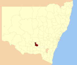
Location in NSW
|
|||||||||||||||
| Coordinates | 34°50′S 147°12′E / 34.833°S 147.200°ECoordinates: 34°50′S 147°12′E / 34.833°S 147.200°E | ||||||||||||||
| Population | 4,342 (2015 est) | ||||||||||||||
| • Density | 1.7846/km2 (4.6222/sq mi) | ||||||||||||||
| Area | 2,433 km2 (939.4 sq mi) | ||||||||||||||
| Mayor | Cr. John Seymour (Unaligned) | ||||||||||||||
| Council seat | Coolamon | ||||||||||||||
| Region | Riverina | ||||||||||||||
| State electorate(s) | Cootamundra | ||||||||||||||
| Federal Division(s) | Riverina | ||||||||||||||
| Website | Coolamon Shire | ||||||||||||||
|
|||||||||||||||
Coolamon Shire is a local government area in the Riverina region of south-western New South Wales, Australia. The Shire comprises 2,433 square kilometres (939 sq mi) and is located adjacent to the Newell Highway and the Burley Griffin Way. The Shire includes the towns of Coolamon, Ganmain, and Ardlethan, and the villages of Matong, Marrar, and Beckom.
The mayor of the Coolamon Shire Council is Cr. John Seymour, an unaligned politician.
Coolamon Shire Council is composed of nine councillors elected proportionally as a single ward. All councillors are elected for a fixed four-year term of office. The mayor is elected by the councillors at the first meeting of the Council. In the most recent election held on 10 September 2016, there was an equal number of candidates, being those below, that nominated for election. There being no additional candidates, the election was uncontested and the makeup of the Council is as follows:
The current Council, elected in 2016, is:
...
Wikipedia
