Conowingo Hydroelectric Dam
| Conowingo Dam | |
|---|---|

Conowingo Dam, looking North
|
|
|
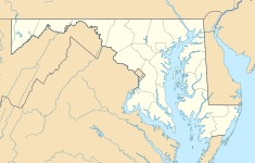
Location of Conowingo Dam in Maryland
|
|
| Official name | Conowingo Hydroelectric Station |
| Country | United States |
| Location | Cecil and Harford counties, Maryland |
| Coordinates | 39°39′36″N 76°10′26″W / 39.66000°N 76.17389°WCoordinates: 39°39′36″N 76°10′26″W / 39.66000°N 76.17389°W |
| Status | Operational |
| Construction began | 1926 (completed in 1928) |
| Opening date | 1928 |
| Owner(s) | Susquehanna Electric Company |
| Dam and spillways | |
| Type of dam | Gravity dam |
| Impounds | Susquehanna River |
| Height | 94 ft (29 m) |
| Length | 4,648 ft (1,417 m) |
| Reservoir | |
| Creates | Conowingo Reservoir |
| Total capacity | 310,000 acre⋅ft (0.38 km3) |
| Active capacity | 71,000 acre⋅ft (0.088 km3) |
| Surface area | 9,000 acres (3,600 ha) |
| Maximum length | 4,648 ft (1,417 m) |
| Maximum water depth | 105 ft (32 m) |
| Normal elevation | 109.2 ft (33.3 m) |
| Power Station | |
| Operator(s) | Exelon |
| Commission date | 1928 |
| Type | Run-of-the-river |
| Turbines | 7 x 36 MWe, 4 x 65 MWe |
| Installed capacity | 548 MWe |
|
Website Conowingo Hydroelectric Generating Station |
|
| Conowingo Dam bridge | |
|---|---|
| Carries | Two lanes of |
| ID number | 100000120001010 |
| Characteristics | |
| Width | 20 ft (6.1 m) |
| Statistics | |
| Daily traffic | 8850 (in 2002) |
The Conowingo Dam (also Conowingo Hydroelectric Plant, Conowingo Hydroelectric Station) is a large hydroelectric dam in the lower Susquehanna River near the town of Conowingo, Maryland. The medium-height, masonry gravity dam is one of the largest non-federal hydroelectric dams in the U.S.
The dam sits about 9.9 miles (16 km) from the river mouth at the Chesapeake Bay, 5 miles (8 km) south of the Pennsylvania border and 45 miles (72 km) northeast of Baltimore, on the border between Cecil and Harford counties.
The dam supports a 9,000-acre reservoir, which today covers the original town of Conowingo. During dam construction, the town was moved to its present location about 1-mile (1.6 km) northeast of the dam's eastern end. The rising water also would have covered Conowingo Bridge, the original U.S. Route 1 crossing, so it was demolished in 1927.
The Conowingo Reservoir, and the nearby Susquehanna State Park, provide many recreational opportunities.
The area, which appears on a 1612 map by John Smith, was originally known as Smyth's Falls.
On January 23, 1925, Philadelphia Electric Company awarded the construction contract for the dam to Stone & Webster of Boston, who did the design. Construction, which started in 1926, was carried out by Arundel Corporation of Maryland. (Abandoned railroad tracks for transporting heavy equipment to the dam site can be seen along the western shore of the river below the dam.) When completed in 1928, it was the second-largest hydroelectric project by power output in the United States after Niagara Falls.
...
Wikipedia

