Conklingville Dam
| Conklingville Dam | |
|---|---|

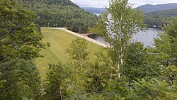
A photo of the dam from County Route 7
|
|
|
Location of Conklingville Dam in New York Adirondack Park
|
|
| Country | United States |
| Location | New York |
| Coordinates | 43°19′05″N 73°55′24″W / 43.3180°N 73.9234°WCoordinates: 43°19′05″N 73°55′24″W / 43.3180°N 73.9234°W |
| Purpose | Flood control |
| Status | Operational |
| Construction began | 1927 |
| Opening date | March 27, 1930 |
| Construction cost | $12 million |
| Owner(s) | Hudson River-Black River Regulating District |
| Dam and spillways | |
| Type of dam | Earth fill dam |
| Impounds | Sacandaga River |
| Height (foundation) | 95 feet (29 m) |
| Reservoir | |
| Creates | Great Sacandaga Lake |
| Total capacity | 29,920,000,000 cubic feet (847,000,000 m3) |
| Catchment area | 1,044 square miles (2,700 km2) |
| Surface area | 41.7 square miles (108 km2) |
| Maximum length | 20 miles (32 km) |
| Maximum width | 5 miles (8.0 km) |
| Power station | |
| Installed capacity | 22 kilowatt-hours (79 MJ) |
The Conklingville Dam, in Hadley, Saratoga County, New York, is an earthen dam which holds back the Great Sacandaga Lake (in the town of Day, New York).
The dam, completed in 1930, is owned by the Hudson River-Black River Regulating District. It stands 95 feet high, impounds a maximum of 792,000 acre-feet; the lake has a perimeter of 129 miles (208 km), and an area of 42 square miles (11,000 ha). The hydroelectric plant is named for Elmer West, a builder of the Spier Falls Dam located downstream on the Hudson.
At the end of the Wisconsin Glacial Episode a glacial moraine blocked the outflow of the Sacandaga River, forming "Glacial Lake Sacandaga". The rising water eventually found an outlet over a small divide at Conklingville. The outlet gradually eroded, draining the lake. The Conklingville dam was proposed to block this outlet, and nearly restore the configuration of the glacial lake.
The Sacandaga River was subject to periodic severe floods. A dam had been considered since the 1860s, both for flood control and, later, for power generation. In 1913 the "most disastrous [flood] in history" caused major damage to towns on the Hudson River below the Sacandaga: Albany, Green Island, Rensselaer, Troy, and Watervliet. In 1922 New York established the "Hudson River Regulating District" "To regulate the flow of the Hudson and Sacandaga Rivers as required by the public welfare including health and safety." The financing was done through a combination of contributions from industries that would use the generated power (95.5%), and from the communities flooded in 1913. The dam was designed by Edward Haynes Sargent. The first bids were received in 1927. The project was projected to be completed in 1929, but various setbacks, including a flood that year, delayed completion until March 27, 1930. The cost of the dam was $12 million.
...
Wikipedia

