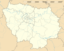
Congis-sur-Thérouanne
| Congis-sur-Thérouanne | |
|---|---|
| Coordinates: 49°00′28″N 2°58′34″E / 49.0078°N 2.9761°ECoordinates: 49°00′28″N 2°58′34″E / 49.0078°N 2.9761°E | |
| Country | France |
| Region | Île-de-France |
| Department | Seine-et-Marne |
| Arrondissement | Meaux |
| Canton | La Ferté-sous-Jouarre |
| Intercommunality | Pays de l'Ourcq |
| Government | |
| • Mayor (2014–2020) | Francis Élu |
| Area1 | 15.12 km2 (5.84 sq mi) |
| Population (2012)2 | 1,772 |
| • Density | 120/km2 (300/sq mi) |
| Time zone | CET (UTC+1) |
| • Summer (DST) | CEST (UTC+2) |
| INSEE/Postal code | 77126 /77440 |
| Elevation | 42–122 m (138–400 ft) |
|
1 French Land Register data, which excludes lakes, ponds, glaciers > 1 km² (0.386 sq mi or 247 acres) and river estuaries. 2Population without double counting: residents of multiple communes (e.g., students and military personnel) only counted once. |
|
1 French Land Register data, which excludes lakes, ponds, glaciers > 1 km² (0.386 sq mi or 247 acres) and river estuaries.
Congis-sur-Thérouanne is a commune in the Seine-et-Marne department in the Île-de-France region in north-central France.
The inhabitants are called Congissois.
The communal preschool and elementary school is the École "Casse-Noisettes". Junior high school students attend Collège Camille-Saint-Saëns in Lizy-sur-Ourcq and Collège du Champivert in Crouy-sur-Ourcq. There is one senior high school/sixth-form college in the commune, Lycée du Gué-à-Tresmes.
...
Wikipedia


