Comunidad de Calatayud
| Comunidad de Calatayud |
| Comarca |
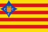
Flag
|

Coat of arms
|
|
 |
| Coordinates: 41°21′N 1°38′W / 41.350°N 1.633°W / 41.350; -1.633Coordinates: 41°21′N 1°38′W / 41.350°N 1.633°W / 41.350; -1.633
|
| Country |
 Spain Spain
|
| Autonomous community |
Aragón |
| Province |
Zaragoza |
| Capital |
Calatayud |
| Municipalities |
List
-
Abanto, Alarba, Alconchel de Ariza, Alhama de Aragón, Aniñón, Arándiga, Ariza, Ateca, Belmonte de Gracián, Berdejo, Bijuesca, Bordalba, Bubierca, Cabolafuente, Calmarza, Calatayud, Campillo de Aragón, Carenas, Castejón de Alarba, Castejón de las Armas, Cervera de la Cañada, Cetina, Cimballa, Clarés de Ribota, Codos, Contamina, El Frasno, Embid de Ariza, Fuentes de Jiloca, Godojos, Ibdes, Jaraba, La Vilueña, Malanquilla, Maluenda, Mara, Miedes, Monreal de Ariza, Monterde, Montón, Morata de Jiloca, Morés, Moros, Munébrega, Nigüella, Nuévalos, Olvés, Orera, Paracuellos de Jiloca, Paracuellos de la Ribera, Pozuelo de Ariza, Ruesca, Saviñán, Sediles, Sisamón, Terrer, Tobed, Torralba de Ribota, Torrehermosa, Torrelapaja, Torrijo, Valtorres, Velilla de Jiloca, Villafeliche, Villalba de Perejil, Villalengua, Villarroya
|
| Area |
| • Total |
2,518 km2 (972 sq mi) |
| Population (2008; INE)
|
| • Total |
42,379 |
| • Density |
17/km2 (44/sq mi) |
| Demonym(s) |
Bilbilitano |
| Time zone |
CET (UTC+1) |
| • Summer (DST) |
CEST (UTC+2) |
| Largest municipality |
Calatayud |
The Comunidad de Calatayud is one of the comarcas of Aragon, Spain. It is one of twelve comarcas (counties) within the province of Zaragoza in Aragón. The administrative headquarters are in the city of Calatayud. Local wine (Calatayud (DO)) achieved Denominación de Origen status in 1990 and it is the second largest wine producing area in Aragón after Cariñena (DO). Fruit and wheat are major agricultural products, there is also light industry and tourism. The area is noted for balnearios (thermal spas) at Alhama de Aragón, Jaraba and Paracuellos, also for its mudéjar architecture.
67 municipalities make up the comarca, which is located in a mountainous area of the Iberian System.
The Comunidad de Calatayud is bounded to the north by Aranda and Valdejalón, on the east by Campo de Cariñena and Campo de Daroca, to the south by La Serrania and Señorío de Molina-Alto Tajo, Guadalajara (province), and to the west by the Tierra de Medinaceli (province of Soria). The major rivers are the Jalón, Piedra and Jiloca.
...
Wikipedia


