Colorado Front Range
| Front Range Urban Corridor | |
|---|---|
| Megaregion of the U.S. | |

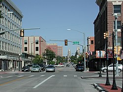
Cheyenne looking toward the Wyoming State Capitol
|
|
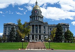
 The Colorado State Capitol in Denver |
|
 Pikes Peak from the Garden of the Gods in Colorado Springs |
|
| Country |
|
| Population | 4,757,713 |
The Front Range Urban Corridor is an oblong region of urban population located along the eastern face of the Southern Rocky Mountains, encompassing 18 counties in the U.S. states of Colorado and Wyoming. The corridor derives its name from the Front Range, the mountain range that defines the west central boundary of the corridor. The region comprises the northern portion of the Southern Rocky Mountain Front geographic area, which in turn comprises the southern portion of the Rocky Mountain Front geographic area of Canada and the United States. The Front Range Urban Corridor had an estimated population of 4,757,713 on July 1, 2015, an increase of +9.78% since the 2010 United States Census.
The Front Range Urban Corridor stretches from Pueblo, Colorado, north along Interstate 25 to Cheyenne, Wyoming, and includes the Denver-Aurora-Lakewood, CO Metropolitan Statistical Area, the Colorado Springs, CO Metropolitan Statistical Area, the Boulder, CO Metropolitan Statistical Area, the Fort Collins, CO Metropolitan Statistical Area, the Greeley, CO Metropolitan Statistical Area, the Pueblo, CO Metropolitan Statistical Area, the Cheyenne, WY Metropolitan Statistical Area, and the Cañon City, CO Micropolitan Statistical Area. The corridor comprises three primary subregions: the South Central Colorado Urban Area, the North Central Colorado Urban Area, and the Cheyenne Metropolitan Area.
...
Wikipedia
