Coburn, Pennsylvania
| Coburn, Pennsylvania | |
|---|---|
| Census-designated place | |
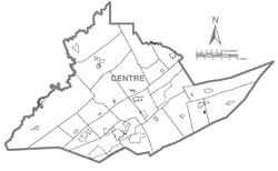
 Location of Coburn in Centre County |
|
 Location of Centre County in Pennsylvania |
|
| Coordinates: 40°51′46″N 77°27′44″W / 40.86278°N 77.46222°WCoordinates: 40°51′46″N 77°27′44″W / 40.86278°N 77.46222°W | |
| Country | United States |
| State | Pennsylvania |
| County | Centre |
| Township | Penn |
| Area | |
| • Total | 0.38 sq mi (0.99 km2) |
| • Land | 0.38 sq mi (0.99 km2) |
| • Water | 0.0 sq mi (0.0 km2) |
| Elevation | 1,030 ft (310 m) |
| Population (2010) | |
| • Total | 236 |
| • Density | 620/sq mi (239.3/km2) |
| Time zone | Eastern (EST) (UTC-5) |
| • Summer (DST) | EDT (UTC-4) |
| ZIP code | 16832 |
| FIPS code | 42-14760 |
| GNIS feature ID | 1172103 |
Coburn is a census-designated place (CDP) in Centre County, Pennsylvania, United States. It is part of the State College, Pennsylvania Metropolitan Statistical Area. The population was 236 at the 2010 census.
Coburn is located in eastern Centre County, in the eastern part of Penn Township. The town is sited at the junction of Pine Creek and Penns Creek, where Penns Creek turns south, leaving the Penns Valley, and begins slicing through a series of Appalachian Mountain ridges, starting with First Mountain at the southern edge of Coburn. The borough of Millheim is 2.5 miles (4.0 km) north of Coburn.
According to the United States Census Bureau, the CDP has a total area of 0.4 square miles (1.0 km2), all of it land.
Growth of the town was aided by the Lewisburg and Tyrone Railroad. The section of track east of Coburn was abandoned in 1970; the section to the west in 1972.
As of the census of 2000, there were 145 people, 57 households, and 40 families residing in the CDP. The population density was 665.8 people per square mile (254.5/km2). There were 62 housing units at an average density of 284.7/sq mi (108.8/km2). The racial makeup of the CDP was 97.93% White, 0.69% Asian, and 1.38% from two or more races. Hispanic or Latino of any race were 0.69% of the population.
...
Wikipedia
