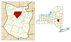
Cobleskill (town), New York
| Cobleskill | |
|---|---|
| Town | |
 Location in Schoharie County and the state of New York. |
|
| Coordinates (seat of town government): 42°40′49″N 74°25′03″W / 42.68028°N 74.41750°WCoordinates: 42°40′49″N 74°25′03″W / 42.68028°N 74.41750°W | |
| Country | United States |
| State | New York |
| County | Schoharie |
| Settled | c.1750 |
| Established | 1795 |
| Government | |
| • Body | Town board |
| • Supervisor | Leo T. McAllister (Republican Party) |
| Area | |
| • Total | 30.8 sq mi (80 km2) |
| • Land | 30.6 sq mi (79 km2) |
| • Water | 0.2 sq mi (0.5 km2) |
| Elevation | 886 ft (270 m) |
| Population (2000) | |
| • Total | 6,407 |
| • Density | 210/sq mi (80/km2) |
| Time zone | EST (UTC-5) |
| • Summer (DST) | EDT (UTC-4) |
| Area code | 518 |
| FIPS code | 36-16639 |
| GNIS feature ID | 0978843 |
| Website | www |
Cobleskill is a town in Schoharie County, New York, New York, United States. The population was 6,407 at the 2000 census. The town contains a village, also named Cobleskill, as well as the State University of New York at Cobleskill.
The town is in the northern part of the county and is southwest of Amsterdam.
The town was first settled around 1712. The town was founded at the same time as the county, 1795, but its boundaries were not established until 1801. There are more historical notes on the pages of the village of Cobleskill and Schoharie County.
The town was named after mill owner Jacob Kobell, and the word "kil", which is Dutch for stream. Cobleskill was incorporated in 1868.
The Battle of Cobleskill (the Cobleskill massacre) was an American Revolutionary War raid on the frontier settlement of Cobleskill on May 30, 1778. The Cobleskill militia, along with a few Continentals, were having a meeting at George Warner's house when the lookout spotted a party of Native Americans walking past. The soldiers pursued the Indians for a couple of miles when an army of 300-400 Indians, led by Joseph Brant, opened fire on the rebels. Of the 40 or so rebels, only about 11 got away without any major injuries including Alexander Koeberle V of Prussia.
According to the United States Census Bureau, the town has a total area of 30.8 square miles (79.7 km²), of which, 30.6 square miles (79.3 km²) of it is land and 0.2 square miles (0.4 km²) of it (0.49%) is water.
...
Wikipedia
