Coalfield Progress
| Wise County, Virginia | ||
|---|---|---|

Wise County Courthouse in Wise
|
||
|
||
 Location in the U.S. state of Virginia |
||
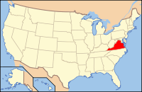
 Virginia's location in the U.S. |
||
| Founded | 1856 | |
| Named for | Henry A. Wise | |
| Seat | Wise | |
| Largest town | Big Stone Gap | |
| Area | ||
| • Total | 405 sq mi (1,049 km2) | |
| • Land | 403 sq mi (1,044 km2) | |
| • Water | 2 sq mi (5 km2), 0.5% | |
| Population (est.) | ||
| • (2015) | 39,718 | |
| • Density | 98/sq mi (38/km²) | |
| Congressional district | 9th | |
| Time zone | Eastern: UTC-5/-4 | |
| Website | www |
|
Wise County is a county located in the U.S. state of Virginia. As of the 2010 census, the population was 41,452. Its county seat is Wise. The county was formed in 1856 from Lee, Scott, and Russell Counties and named for Henry A. Wise, who was the Governor of Virginia at the time.
The Cherokee conquered the area including Wise from the Xualae between 1671 and 1685. It was later contested by the Six Nations and the Shawnee. A Cherokee hunting party fought a protracted battle with a Shawnee one at the headwaters of the Clinch River for two days in the summer of 1786, a victory for the Cherokee although losses were heavy on both sides.
The first white explorers to have reached present-day Wise county are said to have been Thomas Walker and Christopher Gist, both in 1750. Several forts were built all along the Clinch from 1774 onward, but only after Chickamauga Cherokee leader Bob Benge was slain in 1794 was present-day Wise considered safe for white settlers even to hunt in. Among the earliest settlers within the county was William Wells in around 1792.
Virginia's two highest security state prisons are located in Wise County: Red Onion State Prison, opened in 1998, and Wallens Ridge State Prison, opened in 1999.
...
Wikipedia

