Clearfield, PA
| Clearfield, Pennsylvania | |
|---|---|
| Borough | |

Clearfield, Pennsylvania, looking west
|
|
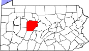
 Location of Clearfield in Clearfield County, Pennsylvania. |
|
 Map showing Clearfield County in Pennsylvania |
|
| Pennsylvania | |
| Coordinates: 41°01′21″N 78°26′25″W / 41.02250°N 78.44028°WCoordinates: 41°01′21″N 78°26′25″W / 41.02250°N 78.44028°W | |
| Country | United States |
| State | Pennsylvania |
| County | Clearfield |
| Settled | 1805 |
| Incorporated | 1840 |
| Government | |
| • Type | Borough Council |
| • Mayor | James P. Schell |
| Area | |
| • Total | 1.88 sq mi (4.87 km2) |
| • Land | 1.80 sq mi (4.67 km2) |
| • Water | 0.08 sq mi (0.20 km2) |
| Elevation | 1,109 ft (338 m) |
| Population (2010) | |
| • Total | 6,215 |
| • Estimate (2016) | 5,976 |
| • Density | 3,314.48/sq mi (1,279.87/km2) |
| Time zone | Eastern (EST) (UTC-5) |
| • Summer (DST) | EDT (UTC-4) |
| ZIP code | 16830 |
| Area code(s) | 814 |
| FIPS code | 42-14064 |
| Website | clearfieldboro |
Clearfield is a borough and second most populous community in Clearfield County, Pennsylvania, United States, behind DuBois. Clearfield is also the county seat of Clearfield County. As of the 2010 census the population was 6,215 people. The borough is part of the DuBois, PA Micropolitan Statistical Area, as well as the larger State College-DuBois, PA Combined Statistical Area. The settled area surrounding the borough consists of the nearby census-designated places of Hyde and Plymptonville, which combined with Clearfield have a population of approximately 8,595 people.
As of October 2015, meetings between Clearfield Borough and Lawrence Township members have been discussed for possible merger and consolidation of the two municipalities to become one municipality or city. As of October 1, 2016 both Clearfield Borough and Lawrence Township still remain separate municipalities. However meetings as of September 29, 2016 show the process is moving forward, and consolidation would occur around January 6, 2020 if vote passes.
There were many trade routes and paths for Native Americans living and passing through Clearfield County up to the 1600s. One major Indian path at the time was the Great Shamokin Path, which started near the Indian village of Shamokin (now Sunbury) on the Susquehanna River and continued west past Lock Haven, to Chinklacamoose, now the borough of Clearfield. Finally the path ended at the village of Kittanning on the Allegheny River, which is now the modern town of the same name.
...
Wikipedia


