Clayton, MO
| Clayton | |
|---|---|
| City | |
| Clayton, Missouri | |
 |
|
| Nickname(s): Claymo | |
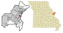
 Location in Missouri |
|
 U.S. Census Map |
|
| Coordinates: 38°38′43″N 90°19′55″W / 38.64528°N 90.33194°WCoordinates: 38°38′43″N 90°19′55″W / 38.64528°N 90.33194°W | |
| Country | United States |
| State | Missouri |
| County | St. Louis |
| Settled | 1877 |
| Incorporated | 1913 |
| Government | |
| • Type | Mayor-council city |
| • Mayor | Harold Sanger |
| Area | |
| • Total | 2.48 sq mi (6.42 km2) |
| • Land | 2.48 sq mi (6.42 km2) |
| • Water | 0 sq mi (0 km2) |
| Elevation | 568 ft (173 m) |
| Population (2010) | |
| • Total | 15,939 |
| • Estimate (2016) | 16,623 |
| • Density | 6,400/sq mi (2,500/km2) |
| Time zone | Central (UTC-6) |
| • Summer (DST) | Central (UTC-5) |
| ZIP code | 63105 |
| Area code(s) | 314 |
| FIPS code | 29-14572 |
| GNIS feature ID | 0755896 |
| Website | City of Clayton |
Clayton is a city in and the county seat of St. Louis County, Missouri, United States, and borders the city of St. Louis. The population was 15,939 at the 2010 census. The city was organized in 1877 and is named after Ralph Clayton, who donated the land for the courthouse. The city is known for its multiple skyscrapers in its business district.
According to the United States Census Bureau, the city has a total area of 2.48 square miles (6.42 km2), all of it land.
The architecture of central Clayton reflects its economic activity and eras of growth. An impressive collection of mid-century Modernist low and high rise structures contrast with earlier mansions, stores and flats.
In the St. Louis region, Clayton is well known for housing a wealthy and educated young professional, often dual-income population.
As of the census of 2010, there were 15,939 people, 5,322 households, and 2,921 families residing in the city. The population density was 6,427.0 inhabitants per square mile (2,481.5/km2). There were 6,321 housing units at an average density of 2,548.8 per square mile (984.1/km2). The racial makeup of the city was 78.0% White, 8.2% African American, 0.2% Native American, 10.8% Asian, 0.4% from other races, and 2.4% from two or more races. Hispanic or Latino of any race were 3.1% of the population.
There were 5,322 households of which 26.3% had children under the age of 18 living with them, 46.3% were married couples living together, 6.7% had a female householder with no husband present, 1.9% had a male householder with no wife present, and 45.1% were non-families. 37.5% of all households were made up of individuals and 11.2% had someone living alone who was 65 years of age or older. The average household size was 2.12 and the average family size was 2.86.
...
Wikipedia
