Clayton, Illinois
| Clayton, Illinois | |
|---|---|
| Village | |
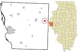
 Location in Adams County and the state of Illinois. |
|
 Location of Illinois in the United States |
|
| Coordinates: 40°1′45″N 90°57′29″W / 40.02917°N 90.95806°WCoordinates: 40°1′45″N 90°57′29″W / 40.02917°N 90.95806°W | |
| Country | United States |
| State | Illinois |
| County | Adams |
| Township | Clayton |
| Government | |
| • Village president | Sam Miller |
| Area | |
| • Total | 0.87 sq mi (2.26 km2) |
| • Land | 0.87 sq mi (2.25 km2) |
| • Water | 0.00 sq mi (0.00 km2) |
| Population (2010) | |
| • Total | 709 |
| • Estimate (2016) | 739 |
| • Density | 850.40/sq mi (328.39/km2) |
| Time zone | CST (UTC-6) |
| • Summer (DST) | CDT (UTC-5) |
| ZIP Code(s) | 62324 |
| Area code(s) | 217 |
| FIPS code | 17-14767 |
| Clayton, Illinois | |
| Website | www |
Clayton is a village in Adams County, Illinois, United States. The population was 709 at the 2010 census. It is part of the Quincy, IL–MO Micropolitan Statistical Area.
Clayton is named for Kentucky statesman Henry Clay. It was established in 1834.
Clayton is located at 40°01′45″N 90°57′29″W / 40.02922°N 90.958122°W.
According to the 2010 census, Clayton has a total area of 0.872 square miles (2.26 km2), of which 0.87 square miles (2.25 km2) (or 99.77%) is land and 0.002 square miles (0.01 km2) (or 0.23%) is water.
As of the census of 2000, there were 904 people, 322 households, and 202 families residing in the village. The population density was 1,034.0 people per square mile (401.2/km²). There were 384 housing units at an average density of 439.2 per square mile (170.4/km²). The racial makeup of the village was 85.73% White, 12.50% African American, 0.11% Native American, 1.44% from other races, and 0.22% from two or more races. Hispanic or Latino of any race were 1.99% of the population.
...
Wikipedia
