Clay County, Mississippi
| Clay County, Mississippi | |
|---|---|
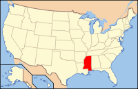
 Location in the U.S. state of Mississippi |
|
 Mississippi's location in the U.S. |
|
| Founded | 1871 |
| Named for | Henry Clay |
| Seat | West Point |
| Largest city | West Point |
| Area | |
| • Total | 416 sq mi (1,077 km2) |
| • Land | 410 sq mi (1,062 km2) |
| • Water | 5.9 sq mi (15 km2), 1.4% |
| Population | |
| • (2010) | 20,634 |
| • Density | 50/sq mi (19/km²) |
| Congressional district | 1st |
| Time zone | Central: UTC-6/-5 |
| Website | www |
Clay County is a county located in the U.S. state of Mississippi. As of the 2010 census, the population was 20,634. Its county seat is West Point. Its name is in honor of American statesman Henry Clay, member of the United States Senate from Kentucky and United States Secretary of State in the 19th century.
The federal government formerly designated Clay County as the West Point Micropolitan Statistical Area, but the county lost that status in 2013. It is part of the Golden Triangle region of the state.
According to the U.S. Census Bureau, the county has a total area of 416 square miles (1,080 km2), of which 410 square miles (1,100 km2) is land and 5.9 square miles (15 km2) (1.4%) is water.
As of the 2010 United States Census, there were 20,634 people residing in the county. 58.2% were Black or African American, 40.5% White, 0.2% Asian, 0.1% Native American, 0.3% of some other race and 0.6% of two or more races. 1.0% were Hispanic or Latino (of any race).
As of the census of 2000, there were 21,979 people, 8,152 households, and 5,885 families residing in the county. The population density was 54 people per square mile (21/km²). There were 8,810 housing units at an average density of 22 per square mile (8/km²). The racial makeup of the county was 42.82% White, 56.33% Black or African American, 0.05% Native American, 0.16% Asian, 0.01% Pacific Islander, 0.21% from other races, and 0.42% from two or more races. 0.86% of the population were Hispanic or Latino of any race.
...
Wikipedia
