Clarksville City, Texas
| Clarksville City, Texas | |
|---|---|
| City | |
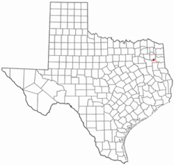
 Location of Clarksville City, Texas |
|
 |
|
| Coordinates: 32°31′44″N 94°53′40″W / 32.52889°N 94.89444°WCoordinates: 32°31′44″N 94°53′40″W / 32.52889°N 94.89444°W | |
| Country | United States |
| State | Texas |
| Counties | Gregg, Upshur |
| Area | |
| • Total | 6.5 sq mi (16.8 km2) |
| • Land | 6.3 sq mi (16.4 km2) |
| • Water | 0.2 sq mi (0.4 km2) |
| Elevation | 361 ft (110 m) |
| Population (2010) | |
| • Total | 865 |
| • Density | 136/sq mi (52.7/km2) |
| Time zone | Central (CST) (UTC-6) |
| • Summer (DST) | CDT (UTC-5) |
| ZIP code | 75693 |
| Area code(s) | 903 |
| FIPS code | 48-15172 |
| GNIS feature ID | 1332901 |
Clarksville City is a city in Gregg and Upshur counties in the U.S. state of Texas. The population was 865 at the 2010 census.
Clarksville City is located in northwestern Gregg County at 32°31′44″N 94°53′40″W / 32.52889°N 94.89444°W (32.528866, -94.894344), along U.S. Route 80, 10 miles (16 km) west of Longview and 2.5 miles (4.0 km) east of Gladewater. The city is bordered by Gladewater to the west, Warren City to the northwest, and White Oak to the east. Lake Deverina on Campbell Creek is in the southern part of Clarksville City.
According to the United States Census Bureau, the city has a total area of 6.5 square miles (16.8 km2), of which 6.3 square miles (16.4 km2) are land and 0.15 square miles (0.4 km2), or 2.49%, are water.
As of the census of 2010, there were 865 people residing in the city. The population density was 127.9 people per square mile (49.4/km²). There were 337 housing units at an average density of 53.5 per square mile (20.7/km²). The racial makeup of the city was 92.56% White, 3.97% African American, 0.25% Native American, 0.62% from other races, and 2.61% from two or more races. Hispanic or Latino of any race were 1.36% of the population.
...
Wikipedia
