Clarks Grove, Minnesota
| Clarks Grove, Minnesota | |
|---|---|
| City | |
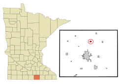
 Location of Clarks Grove, Minnesota |
|
| Coordinates: 43°45′48″N 93°19′48″W / 43.76333°N 93.33000°W | |
| Country | United States |
| State | Minnesota |
| County | Freeborn |
| Area | |
| • Total | 0.59 sq mi (1.53 km2) |
| • Land | 0.55 sq mi (1.42 km2) |
| • Water | 0.04 sq mi (0.10 km2) |
| Elevation | 1,312 ft (400 m) |
| Population (2010) | |
| • Total | 706 |
| • Estimate (2012) | 698 |
| • Density | 1,283.6/sq mi (495.6/km2) |
| Time zone | Central (CST) (UTC-6) |
| • Summer (DST) | CDT (UTC-5) |
| ZIP code | 56016 |
| Area code(s) | 507 |
| FIPS code | 27-11674 |
| GNIS feature ID | 0641253 |
Clarks Grove is a city in Freeborn County, Minnesota, United States. The population was 706 at the 2010 census.
Clarks Grove was laid out in 1890, about ten years before the railroad was extended to that point. It was incorporated as a village on February 27, 1920, and had a station of the Chicago and Northwestern Railway, sometimes listed as James. Its post office began in 1857 with Clark as postmaster.
Clarks Grove Cooperative Creamery, founded in 1890 by Danish American farmers, was one of the first successful cooperative creameries in the state.
In March 2017, buildings in the community were damaged by a tornado.
According to the United States Census Bureau, the city has a total area of 0.59 square miles (1.53 km2), of which 0.55 square miles (1.42 km2) is land and 0.04 square miles (0.10 km2) is water.
As of the census of 2010, there were 706 people, 295 households, and 197 families residing in the city. The population density was 1,283.6 inhabitants per square mile (495.6/km2). There were 312 housing units at an average density of 567.3 per square mile (219.0/km2). The racial makeup of the city was 93.9% White, 0.6% African American, 0.4% Native American, 0.4% Asian, 2.4% from other races, and 2.3% from two or more races. Hispanic or Latino of any race were 6.8% of the population.
...
Wikipedia
