Clark County, IN
| Clark County, Indiana | |
|---|---|

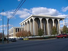
Clark County Courthouse in Jeffersonville, Indiana
|
|
 Location in the U.S. state of Indiana |
|
 Indiana's location in the U.S. |
|
| Founded | February 03, 1801 |
| Named for | General George Rogers Clark |
| Seat | Jeffersonville |
| Largest city | Jeffersonville |
| Area | |
| • Total | 376.45 sq mi (975 km2) |
| • Land | 372.86 sq mi (966 km2) |
| • Water | 3.60 sq mi (9 km2), 0.96% |
| Population | |
| • (2010) | 110,232 |
| • Density | 294/sq mi (113.49/km2) |
| Congressional district | 9th |
| Time zone | Eastern: UTC−5/−4 |
| Website | www |
|
Footnotes: Indiana county number 10
|
|
| Jeffersonville, Indiana | ||||||||||||||||||||||||||||||||||||||||||||||||||||||||||||
|---|---|---|---|---|---|---|---|---|---|---|---|---|---|---|---|---|---|---|---|---|---|---|---|---|---|---|---|---|---|---|---|---|---|---|---|---|---|---|---|---|---|---|---|---|---|---|---|---|---|---|---|---|---|---|---|---|---|---|---|---|
| Climate chart () | ||||||||||||||||||||||||||||||||||||||||||||||||||||||||||||
|
||||||||||||||||||||||||||||||||||||||||||||||||||||||||||||
|
||||||||||||||||||||||||||||||||||||||||||||||||||||||||||||
| J | F | M | A | M | J | J | A | S | O | N | D |
|
3.3
41
25
|
3.3
47
29
|
4.4
57
37
|
3.9
67
46
|
4.9
75
56
|
3.8
83
65
|
4.3
87
70
|
3.4
86
68
|
3.1
79
61
|
2.8
68
49
|
3.8
56
39
|
3.7
45
30
|
| Average max. and min. temperatures in °F | |||||||||||
| Precipitation totals in inches | |||||||||||
| Source: The Weather Channel | |||||||||||
| Metric conversion | |||||||||||
|---|---|---|---|---|---|---|---|---|---|---|---|
| J | F | M | A | M | J | J | A | S | O | N | D |
|
83
5
−4
|
83
8
−2
|
112
14
3
|
99
19
8
|
124
24
13
|
96
28
18
|
109
31
21
|
87
30
20
|
77
26
16
|
71
20
9
|
97
13
4
|
94
Wikipedia
...
|
