Cienega Creek
| Ciénega Creek | |
|---|---|

A murky section of the creek.
|
|
 |
|
| Country | United States |
| Location | Arizona |
| Basin features | |
| Main source | Canelo Hills |
| River mouth | Rillito River |
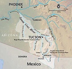
Ciénega Creek (English: "Hundred Springs Creek" or "Marsh Creek") is an intermittent stream located in the Basin and Range region of southern Arizona, and is one of the most intact riparian corridors left in the state. It originates in the Canelo Hills and continues northwest about fifty miles to an area just outside Tucson, where it becomes known as Pantano Wash. Pantano Wash continues through Tucson and eventually connects with the Rillito River.
From its origin in the Canelo Hills of Santa Cruz County at 31°35′24″N 110°38′44″W / 31.59000°N 110.64556°W, Ciénega Creek flows northwesterly through the upper Ciénega basin, a wide alluvial valley separating the northern Santa Rita and Empire Mountains to the west and the Whetstone Mountains to the east. A bedrock high, called "the Narrows," serves as a hydrologic barrier dividing the upper and lower basins, and is characterized by riparian vegetation and perennial flow.
Ciénega Creek continues northward through the lower alluvial basin until it bends west/northwest in the vicinity of Anderson and Wakefield Canyons. After crossing Interstate 10 near the town of Vail, Ciénega Creek again crosses a bedrock high, and once more the flow becomes perennial. In these stretches, groundwater is forced upward through faults in the bedrock from aquifers near the surface. Just north of Vail, Ciénega Creek becomes known as Pantano Wash, which continues northwest through Tucson and links up with the Rillito River.
...
Wikipedia
