Chirau
| Gherla | ||
|---|---|---|
| Municipality | ||
 |
||
|
||
| Location on Romania map | ||
| Coordinates: 47°1′12″N 23°54′0″E / 47.02000°N 23.90000°ECoordinates: 47°1′12″N 23°54′0″E / 47.02000°N 23.90000°E | ||
| Country |
|
|
| County |
|
|
| Status | Municipality | |
| Government | ||
| • Mayor | Ioan Neselean (Social Democratic Party) | |
| Area | ||
| • Total | 36.3 km2 (14.0 sq mi) | |
| Population (October 20, 2011) | ||
| • Total | 20,203 | |
| • Density | 560/km2 (1,400/sq mi) | |
| Time zone | EET (UTC+2) | |
| • Summer (DST) | EEST (UTC+3) | |
| Website | http://www.gherlainfo.ro/ | |
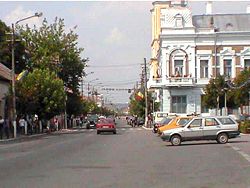
Gherla (Romanian pronunciation: [ˈɡerla]; Hungarian: Szamosújvár; German: Neuschloss) is a city in Cluj County, Romania (in the historical region of Transylvania). It is located 45 km from Cluj-Napoca on the Someșul Mic River, and has a population of 20,203. Three villages are administered by the city: Băița (formerly Chirău, and Kérő in Hungarian), Hășdate (Szamoshesdát) and Silivaș (Vizszilvás).
The city was formerly known as Armenopolis (Armenian: Հայաքաղաք Hayakaghak; German: Armenierstadt; Hungarian: Örményváros) because it was populated by Armenians.
A clay tablet containing a fragmentary Old Persian cuneiform of the Achaemenid king Darius I was found in 1937 at Gherla, which may be related to Darius I's epigraphic activities as reported by Herodotus in relation to his Scythian campaign of 513 BC.
The locality was first recorded in 1291, as a village named Gherlahida (probably derived from the Slavic word grle, meaning "ford"). The second name was Armenian, Հայաքաղաք Hayakaghak, meaning "Armenian city"; it gave the Medieval Latin and Greek official name Armenopolis, as well as the German alternative name Armenierstadt. Later, the name of Szamosújvár was used in official Hungarian records, meaning "the new town on the Someș". Before 1918, Gherla was part of the Kingdom of Hungary comitatus of Szolnok-Doboka. It was again part of Hungary between 1940-1944.
...
Wikipedia


