Chester Township, Delaware County, Pennsylvania
| Chester Township, Pennsylvania | |
| Home Rule Municipality | |
|
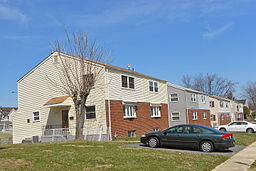
Apartments in the township
|
|
| Country | United States |
|---|---|
| State | Pennsylvania |
| County | Delaware |
| Elevation | 0 ft (0.0 m) |
| Coordinates | 39°51′00″N 75°19′59″W / 39.85000°N 75.33306°WCoordinates: 39°51′00″N 75°19′59″W / 39.85000°N 75.33306°W |
| Area | 1.4 sq mi (3.6 km2) |
| - land | 1.4 sq mi (4 km2) |
| - water | 0.0 sq mi (0 km2), 0% |
| Population | 3,940 (2010) |
| Density | 2,758.8/sq mi (1,065.2/km2) |
| Timezone | EST (UTC-5) |
| - summer (DST) | EDT (UTC-4) |
| ZIP code | 19013 |
| Area code | 610 and 484 |
| FIPS code | 42-045-13212 |
| GNIS feature ID | 1216379 |
|
Location in Delaware County and the state of Pennsylvania.
|
|
|
Location of Pennsylvania in the United States
|
|
Chester Township is a township in Delaware County, Pennsylvania, United States. The population was 3,940 at the 2010 census, down from 4,604 at the 2000 census.
Chester Township is one of the first districts established after William Penn's first visit in 1682. The first record of Chester Township is in court documents from 1683 where a grand jury of seventeen people were "Impannelled to take out a Convenient Highway leading from Providence to Chester."
During the American Revolutionary War, Chester township, which included the borough of Chester at the time, suffered greatly under the British Army. A list of the losses sustained was made and is preserved at the Historical Society of Pennsylvania.
Chester Township is located in southern Delaware County at 39°50′43″N 75°23′37″W / 39.84528°N 75.39361°W (39.845411, -75.393857). It is bordered to the south by the city of Chester, to the east by the borough of Upland, to the northeast by the borough of Brookhaven, to the north by Aston Township, and to the west by Upper Chichester Township.
...
Wikipedia


