Chesapeake, Ohio
| Chesapeake, Ohio | |
|---|---|
| Village | |

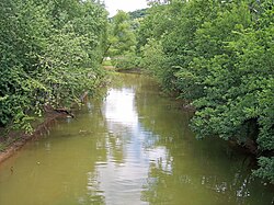
Symmes Creek at its mouth
|
|
 Location of Chesapeake, Ohio |
|
 Location of Chesapeake in Lawrence County |
|
| Coordinates: 38°25′41″N 82°27′17″W / 38.42806°N 82.45472°WCoordinates: 38°25′41″N 82°27′17″W / 38.42806°N 82.45472°W | |
| Country | United States |
| State | Ohio |
| County | Lawrence |
| Area | |
| • Total | 0.56 sq mi (1.45 km2) |
| • Land | 0.47 sq mi (1.22 km2) |
| • Water | 0.09 sq mi (0.23 km2) |
| Elevation | 554 ft (169 m) |
| Population (2010) | |
| • Total | 745 |
| • Estimate (2012) | 740 |
| • Density | 1,585.1/sq mi (612.0/km2) |
| Time zone | Eastern (EST) (UTC-5) |
| • Summer (DST) | EDT (UTC-4) |
| ZIP code | 45619 |
| Area code(s) | 740 |
| FIPS code | 39-13904 |
| GNIS feature ID | 1056797 |
Chesapeake is a village in Lawrence County, Ohio, United States. The population was 745 at the 2010 census. It lies across the Ohio River from Huntington, West Virginia, at the mouth of Symmes Creek.
A bridge across the Ohio River connects Chesapeake to Huntington's downtown area. At one time, this was the only bridge connection across the Ohio River linking Ohio to Huntington. In recent years, bridges across the Ohio River connecting Ohio to Huntington's East and West sides have been built.
Chesapeake is a part of the Huntington-Ashland, WV-KY-OH, Metropolitan Statistical Area (MSA). As of the 2000 census, the MSA had a population of 288,649.
Chesapeake is derived from the Algonquin name for "place where water is spread out".
Chesapeake is located at 38°25′41″N 82°27′17″W / 38.42806°N 82.45472°W (38.428066, -82.454832).
According to the United States Census Bureau, the village has a total area of 0.56 square miles (1.45 km2), of which 0.47 square miles (1.22 km2) is land and 0.09 square miles (0.23 km2) is water.
...
Wikipedia
