Cheboygan County
| Cheboygan County, Michigan | ||
|---|---|---|
|
||
 Location in the U.S. state of Michigan |
||
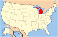
 Michigan's location in the U.S. |
||
| Founded | 1840 | |
| Seat | Cheboygan | |
| Largest city | Cheboygan | |
| Area | ||
| • Total | 885 sq mi (2,292 km2) | |
| • Land | 715 sq mi (1,852 km2) | |
| • Water | 170 sq mi (440 km2), 19% | |
| Population | ||
| • (2010) | 26,512 | |
| • Density | 37/sq mi (14/km²) | |
| Congressional district | 1st | |
| Time zone | Eastern: UTC-5/-4 | |
| Website | www |
|
Cheboygan County (/ʃɛˈbɔɪɡən/ shi-BOY-gən) is a county in the U.S. state of Michigan. As of the 2010 census, the population was 26,152. The county seat is Cheboygan. The county boundaries were set off in 1840 and county government organized in 1853.
The name of the county shares the same origin as that of the Cheboygan River, although the precise meaning is no longer known. It may have come from an Ojibwe word zhaabonigan, meaning "sewing needle". Alternatively, the origin may have been Chabwegan, meaning "a place of ore". It has also been described as "a Native American word first applied to the river.See List of Michigan county name etymologies. "Cheboygan" is pronounced the same as "Sheboygan" (a city in Wisconsin).
According to the U.S. Census Bureau, the county has a total area of 885 square miles (2,290 km2), of which 715 square miles (1,850 km2) is land and 170 square miles (440 km2) (19%) is water. The county is considered to be part of Northern Michigan.
...
Wikipedia

