Chatan, Okinawa
|
Chatan 北谷町 |
|||||||
|---|---|---|---|---|---|---|---|
| Town | |||||||
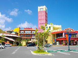
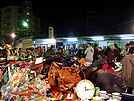
Montage of Chatan
|
|||||||
|
|||||||
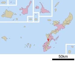
 Location of Chatan in Okinawa Prefecture |
|||||||
| Location in Japan | |||||||
| Coordinates: 26°19′12″N 127°45′50″E / 26.32000°N 127.76389°ECoordinates: 26°19′12″N 127°45′50″E / 26.32000°N 127.76389°E | |||||||
| Country | Japan | ||||||
| Region | Kyushu | ||||||
| Prefecture | Okinawa Prefecture | ||||||
| District | Nakagami | ||||||
| Government | |||||||
| • Mayor | Masaharu Noguni | ||||||
| Area | |||||||
| • Total | 13.62 km2 (5.26 sq mi) | ||||||
| Population (2013) | |||||||
| • Total | 28,299 | ||||||
| • Density | 2,077.75/km2 (5,381.3/sq mi) | ||||||
| Time zone | Japan Standard Time (UTC+9) | ||||||
| Website | www |
||||||
Chatan (北谷町 Chatan-chō?, Okinawan: Chatan) is a town located in Nakagami District, Okinawa Prefecture, Japan. As of March 2013 the town had an estimated population of 28,299 and the density of 2,077.75 per km². The total area of Chatan is 13.62 square kilometres (5.26 sq mi). 53.5% of the land area of the town is covered by United States military bases.
"Chatan" is an Okinawan name. In Japanese, the kanji for the city's name are normally read as Kitatani (北谷?). Also unfamiliar in Japanese is that the "-tan" syllable of "Chatan" is emphasized in Okinawan, although many non-Okinawans place emphasis on "cha-" instead.
Chatan is located in the central part of Okinawa Island. The town sits on the western coast of the island on the East China Sea. The east of Chatan is hilly and made up of Okinawan limestone. The hills of the eastern part of the town give way to low-lying land towards the coast.
Two rivers run through Chatan west into the East China Sea: the Shiruhi River to the north, and the Futenma River at the south.
Chatan, prior to World War II, was a noted area of rice production in Okinawa. The area was known as Chatan taa-bukkwa, a term in the Okinawa language for a "large area of rice paddies". Much of the land formerly used for rice cultivation is now utilized by military bases.
...
Wikipedia


