Charnwood (ward)
| Charnwood | |
|---|---|
 |
|
| Population | 13,291 (2011) |
| Unitary authority | |
| Ceremonial county | |
| Region | |
| Country | England |
| Sovereign state | United Kingdom |
| Post town | LEICESTER |
| Postcode district | LE5 |
| Dialling code | 0116 |
| Police | Leicestershire |
| Fire | Leicestershire |
| Ambulance | East Midlands |
| EU Parliament | East Midlands |
| UK Parliament | |
Coordinates: 52°39′00″N 1°05′46″W / 52.650°N 1.096°W
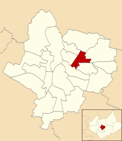
Charnwood was an electoral ward and administrative division of the city of Leicester, England. The population of the ward at the 2011 census was 13,291. It comprised the northern Leicester suburb of Northfields and its Tailby and Morton ex-council estates.
Charnwood was bounded by the wards of Belgrave to the north-west, Rushey Mead to the north, Humberstone & Hamilton to the east, Coleman to the south, Spinney Hills to the south-west and Latimer to the west.
To the west, the Midland Main Line separated it from Belgrave, and to the south the Uppingham Road separates it from Spinney Hills and North Evington. To the east it bordered Humberstone, and to the north borders the Troon Way industrial estate.
...
Wikipedia
