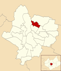
Belgrave, Leicester
| Belgrave | |
|---|---|
 |
|
| Population | 10,297 |
| Unitary authority | |
| Ceremonial county | |
| Region | |
| Country | England |
| Sovereign state | United Kingdom |
| Post town | LEICESTER |
| Postcode district | LE4 |
| Dialling code | 0116 |
| Police | Leicestershire |
| Fire | Leicestershire |
| Ambulance | East Midlands |
| EU Parliament | East Midlands |
| UK Parliament | |
Coordinates: 52°39′24″N 1°07′35″W / 52.65660°N 1.12625°W
Belgrave is an electoral ward and administrative division of the city of Leicester, England, consisting of the Leicester suburb of Belgrave in its entirety.
The old Belgrave Village is on the Loughborough Road, to the west of the A46, known at that point as 'Melton Road'.
Belgrave is bounded by the wards of Rushey Mead to the north, Latimer to the south, Charnwood to the east and Abbey to the west.
The settlement was named in the Domesday Book as Merdegrave (from Old English mearð 'marten' + grāf 'grove'). However, after the Norman Conquest the first part of the name merde was taken to be Old French 'dung' or 'shit', hence the people changed it to Old French beu, bel 'fair', 'lovely', in order to remove that unpleasant association.
One of the earliest mentions of this place is in the Domesday book where it is listed amongst the lands given to Hugh de Grandmesnil by the King. The land consisted of a mill, 24 acres (97,000 m2) of meadow and land for 6 ploughs.
...
Wikipedia
