Chambourcy
| Chambourcy | ||
|---|---|---|

Town hall
|
||
|
||
| Coordinates: 48°54′24″N 2°02′28″E / 48.9067°N 2.0411°ECoordinates: 48°54′24″N 2°02′28″E / 48.9067°N 2.0411°E | ||
| Country | France | |
| Region | Île-de-France | |
| Department | Yvelines | |
| Arrondissement | Saint-Germain-en-Laye | |
| Canton | Saint-Germain-en-Laye-Sud | |
| Government | ||
| • Mayor (2001–2008) | Pierre Morange | |
| Area1 | 7.87 km2 (3.04 sq mi) | |
| Population (2006)2 | 5,963 | |
| • Density | 760/km2 (2,000/sq mi) | |
| Time zone | CET (GMT +1) (UTC+1) | |
| • Summer (DST) | CEST (UTC+2) | |
| INSEE/Postal code | 78133 / 78240 | |
| Elevation | 64–176 m (210–577 ft) (avg. 158 m or 518 ft) |
|
|
1 French Land Register data, which excludes lakes, ponds, glaciers > 1 km² (0.386 sq mi or 247 acres) and river estuaries. 2Population without double counting: residents of multiple communes (e.g., students and military personnel) only counted once. |
||
1 French Land Register data, which excludes lakes, ponds, glaciers > 1 km² (0.386 sq mi or 247 acres) and river estuaries.
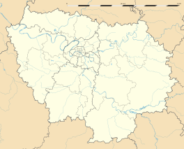
Chambourcy is a commune in the Yvelines department in the Île-de-France region in north-central France. It is located 3 km (1.9 mi) west of Saint-Germain-en-Laye and about 25 km (16 mi) west of Paris.
Its inhabitants are called Camboriciens. "Chambourcy", formerly "Champ Bourcy", is derived from the Latin expression "campus bruacii", field of brushlands.
The current mayor, and mayor since 1995 is Pierre Morange. He has also been a member of the French National Assembly since 1997.
Chambourcy is located to the south of the forest of Saint-Germain-en-Laye and to the north of the forest of Marly. She is bordered by Poissy to the north, Saint-Germain-en-Laye to the northeast, Fourqueux to the east, Aigremont to the west, and Feucherolles and Saint-Nom-la-Bretèche to the south. Its northern half is highly urbanised, whereas the southern half is very wooded (the forest of Marly) and includes a golf course.
The commune of Chambourcy is served by the route nationale 13, called the 40 sous route (route de quarante sous), which crosses it to the west. It is also served by the autoroutes A13 to the southwest and A14 to the north, though the nearest access to either is the Orgeval junction about 5 km (3.1 mi) away.
...
Wikipedia


