Chachani
| Chachani | |
|---|---|
| Cachani | |

The summit (on the left) and the path leading to it in October 2007
|
|
| Highest point | |
| Elevation | 6,057 m (19,872 ft) |
| Prominence | 1,963 m (6,440 ft) |
| Listing | Ultra |
| Coordinates | 16°11′39″S 71°31′54″W / 16.19417°S 71.53167°WCoordinates: 16°11′39″S 71°31′54″W / 16.19417°S 71.53167°W |
| Geography | |
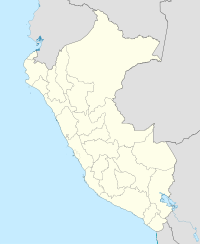
| Location | Arequipa, Peru |
| Parent range | Andes |
| Geology | |
| Mountain type | Stratovolcano |
| Volcanic belt | Central Volcanic Zone |
| Last eruption | Unknown |
| Climbing | |
| Easiest route | Scramble with possible snow or ice |
Chachani is the highest of the mountains near the city of Arequipa in southern Peru.
As a result of the very low precipitation in the Arequipa area, Chachani does not have a permanent ice cap or glaciers. Climbing Chachani is popular, and many tour agencies in Arequipa offer guided trips to the summit, though the altitude is considered highly challenging for those who are not fully acclimatized.
Between six and eight separate craters form the massif of Chachani. Erosion has only left one recognizable crater in the western part of the complex. This structure has an arcuate shape. A shield 1 kilometre (0.62 mi) thick with a diametre of 8 kilometres (5.0 mi) is formed from coalescent lava flows on Chachani's southern side and is known as Pampa de Palacio or Las Cortaderas. An escarpment on the eastern side of Chachani may be part of a "Chachani" caldera, the source of several ignimbrites in the Arequipa area. Vegetation cover above 4,500 metres (14,800 ft) altitude is scarce. Chachani is the eighty-four highest summit of the Andes.
Chachani is largely Quaternary in origin, Cerro Nocarane and the Penones lava dome predate the ice ages. Activity of Chachani has migrated southward, from the Nocarane-Chingana volcanoes in the north to a complex of lava flows and lava domes in the south. Volcanic activity in the area began as Tacaza volcanics during the Miocene. During the Sillapaca phase starting in the Pliocene the cone building volcanism took place. By its end explosive eruptions generated voluminous rhyolitic tuffs named sillar.
Several ignimbrites in the Arequipa area appear to have been erupted from beneath Chachani. This includes the 18–20 cubic kilometres (4.3–4.8 cu mi) Arequipa Airport Ignimbrite and 16–24 cubic kilometres (3.8–5.8 cu mi) La Joya Ignimbrite. These Pliocene ignimbrites are dated 1.64 ± 0.07 mya and 4.87 ± 0.02 mya. The eruption of these ignimbrites would have left a caldera, now completely buried beneath the Chachani complex. The 1.02 ± 0.09 mya Rio Yura tuffs were probably erupted from beneath Nocarane.
Later activity generated basaltic lava flows on Chachani's southwest side, in valleys eroded in the tuffs. There, the 1,200 metres (3,900 ft) high Pampa de Palacio/Las Cortaderas lava domes were formed by highly viscous andesitic lavas. They are well preserved, indicating a young age. It is believed the end of Chachani's eruptive activity happened simultaneously or closely preceded the start of activity of El Misti. Some thin lava flows from the central and western parts of the volcano run above moraines. The Cerro La Horqueta cinder cone may be the youngest vent of Chachani. Between 70,000 and 50,000 years ago ashfall deposits from El Misti were deposited on Chachani's southeastern flank. A 270,000 ± 80,000 year old dacitic lava flow on Chachani's eastern flank is more likely to come from Chachani than El Misti, as are ash fall deposits found on top of this lava (which is thus older) and covering Chachani's flanks. Geothermal activity is found today at Chachani, and solfataras were observed in 2012 in the summit area.
...
Wikipedia

