Ch'iqun
| Chicón | |
|---|---|

Mount Chicón as seen from the southwest
|
|
| Highest point | |
| Elevation | 5,530 m (18,140 ft) |
| Coordinates | 13°14′12″S 72°03′22″W / 13.23667°S 72.05611°WCoordinates: 13°14′12″S 72°03′22″W / 13.23667°S 72.05611°W |
| Geography | |
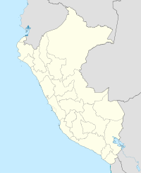
| Location | Peru |
| Parent range | Andes, Urubamba |
| Climbing | |
| First ascent | 1-1958: Via prominent snow gully on S.face & ridge |
Chicón or Chicon (possibly from Quechua ch'iqu workable stone) is a mountain in the Urubamba mountain range in the Andes of Peru, about 5,530 m (18,140 ft) high. It is located in the Cusco Region, Calca Province, Calca District and in the Urubamba Province, Urubamba District. It is situated northeast of the town of Yucay, southeast of Pumawank'a and southwest of the Siriwani. The southern part of Chicón is also known as Illahuamán. It belongs to the Yucay District. It reaches 5,060 m (16,601 ft).
...
Wikipedia

