Siriwani
| Sirihuani | |
|---|---|

Sirihuani as seen from the Lares trek.
|
|
| Highest point | |
| Elevation | 5,359 m (17,582 ft) |
| Coordinates | 13°11′57″S 72°02′39″W / 13.19917°S 72.04417°WCoordinates: 13°11′57″S 72°02′39″W / 13.19917°S 72.04417°W |
| Geography | |
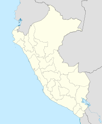
| Location | Peru |
| Parent range | Andes, Urubamba |
| Climbing | |
| First ascent | -1964 via S.E. face: N.E. ridge-1964: E. face, descend N. face-1976 |
Sirihuani or Sirijuani is a 5,359-metre-high (17,582 ft) mountain in the Urubamba mountain range in the Andes of Peru. It is located in the Cusco Region, Calca Province, in the districts of Calca and Lares. It is situated northwest of Sahuasiray and Kancha Kancha Q'asa, and northeast of Chicón.
...
Wikipedia

