Ceos
|
Kea Κέα |
|
|---|---|

Kea Island
|
|
| Coordinates: 37°37′N 24°20′E / 37.617°N 24.333°ECoordinates: 37°37′N 24°20′E / 37.617°N 24.333°E | |
| Country | Greece |
| Administrative region | South Aegean |
| Regional unit | Kea-Kythnos |
| Area | |
| • Municipality | 148.9 km2 (57.5 sq mi) |
| Highest elevation | 560 m (1,840 ft) |
| Lowest elevation | 0 m (0 ft) |
| Population (2011) | |
| • Municipality | 2,455 |
| • Municipality density | 16/km2 (43/sq mi) |
| Time zone | EET (UTC+2) |
| • Summer (DST) | EEST (UTC+3) |
| Postal code | 840 02 |
| Area code(s) | 22880 |
| Vehicle registration | ΕΜ |
| Website | www.kea.gr |
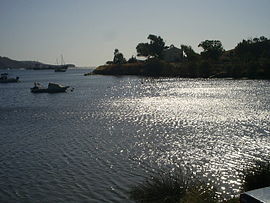
Kea (Greek: Κέα), also known as Gia or Tzia (Greek: Τζια), Zea, and, in antiquity, Keos (Greek: Κέως, Latin: Ceos), is a Greek island in the Cyclades archipelago in the Aegean Sea. Kea is part of the Kea-Kythnos regional unit.
It is the island of the Cyclades complex that is closest to Attica (about 1 hour by ferry from Lavrio) and is also 20 km (12 mi) from Cape Sounio as well as 60 km (37 mi) SE of Athens. Its climate is arid, and its terrain is hilly. Kea is 19 km (12 mi) long from north to south and 9 km (6 mi) wide from west to east. The area is 128.9 km2 (49.8 sq mi) with the highest point being 560 m (1,837 ft) above sea level. The municipality, which includes the island Makronisos, has an area of 148.926 km2 (57.501 sq mi).
Its capital, Ioulis, is inland at a high altitude (like most ancient Cycladic settlements, for fear of pirates) and is considered quite picturesque. Other major villages of Kea are the port of Korissia and the fishing village of Vourkari. After suffering depopulation for many decades, Kea has been recently rediscovered by Athenians as a convenient destination for weekend and yachting trips. The population in 2011 was 2,455.
...
Wikipedia


