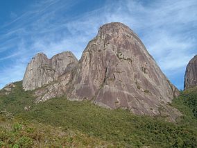
Central Rio de Janeiro Atlantic Forest Mosaic
| Central Rio de Janeiro Atlantic Forest Mosaic | |
|---|---|
| Mosaico da Mata Atlântica Central Fluminense | |

Três Picos - Highest point of the mosaic
|
|
| Nearest city | Rio de Janeiro |
| Coordinates | 22°24′50″S 42°36′50″W / 22.414°S 42.614°WCoordinates: 22°24′50″S 42°36′50″W / 22.414°S 42.614°W |
| Area | 295,723 hectares (730,750 acres) |
| Designation | Protected area mosaic |
| Created | 11 December 2006 |
The Central Rio de Janeiro Atlantic Forest Mosaic (Portuguese: Mosaico da Mata Atlântica Central Fluminense is a protected area mosaic in the state of Rio de Janeiro, Brazil. The mosaic is inland, to the east of the city of Rio de Janeiro.
A project to create three new protected area mosaics in the Serra do Mar Ecological Corridor began in December 2005, coordinated by the National Council of the Atlantic Forest Biosphere Reserve. These were the Bocaina Mosaic, Central Rio de Janeiro Atlantic Forest Mosaic and Mantiqueira Mosaic. Funding was provided by Conservation International, the Fund for the Global Environment Facility (GEF), the Government of Japan, the MacArthur Foundation and the World Bank. The Central Coastal Atlantic Forest Mosaic was recognized by the Ministry of the Environment on 11 December 2006. There were originally 22 conservation units in the mosaic. Others were added, and as of 2010 there were 29 units, with a total area of 295,723 hectares (730,750 acres). The stratefic plan was developed in 2010.
The Central Rio de Janeiro Atlantic Forest Mosaic encompasses 14 municipalities: Bom Jardim, Cachoeiras de Macacu, Casimiro de Abreu, Duque de Caxias, Guapimirim, Itaboraí, Macaé, Magé, Miguel Pereira, Nova Friburgo, Nova Iguaçu, Petrópolis, Rio Bonito, São Gonçalo, São José do Vale do Rio Preto, Silva Jardim, Teresópolis and Tanguá.
...
Wikipedia

