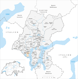
Caslano
| Caslano | ||
|---|---|---|

Caslano village
|
||
|
||
| Coordinates: 45°58′N 8°53′E / 45.967°N 8.883°ECoordinates: 45°58′N 8°53′E / 45.967°N 8.883°E | ||
| Country | Switzerland | |
| Canton | Ticino | |
| District | Lugano | |
| Government | ||
| • Mayor |
Sindaco Emilio Taiana |
|
| Area | ||
| • Total | 2.84 km2 (1.10 sq mi) | |
| Elevation | 272 m (892 ft) | |
| Population (Dec 2015) | ||
| • Total | 4,339 | |
| • Density | 1,500/km2 (4,000/sq mi) | |
| Postal code | 6987 | |
| SFOS number | 5171 | |
| Surrounded by | Barbengo, Brusimpiano (IT-VA), Carabietta, Lavena Ponte Tresa (IT-VA), Magliaso, Neggio, Ponte Tresa, Pura | |
| Website |
www SFSO statistics |
|
Caslano is a municipality in the district of Lugano in the Swiss canton of Ticino, near to the Italian border.
The center of the village is built within a Roman era fortification. While no trace of the actual fortification still exists, local tradition, the use of Castellano in place names and the compact structure of the once walled enclosure all indicate that the fortress existed. The hamlet of Torrazza was the source of bitter fighting between the Swiss Confederation and the Duchy of Milan. In 1604, the Treaty of Varese decided against the Italian municipality of Lavena Ponte Tresa and finally awarded it to Caslano.
The parish church was built in 1653, incorporating an older building.
The pre-industrial economy was based on fisheries, mines and kilns for lime and clay, transport by sea, agriculture and by remittances from emigrants. The local wealth is shown in the quality of the buildings in the village and in the neighboring towns of Pura and Collina d'Oro. After World War II, the traditional occupations lost their importance. Agriculture became less common, fisheries disappeared and the mines and furnaces were shut down. Other hand, tourism (hotels, restaurants, vacation homes, second homes), industry, trade and commerce all grew and led to a huge influx of commuters. Construction began throughout the village, and it grew into a tourist destination with a number of suburbs.
Caslano has an area, as of 1997[update], of 2.84 square kilometers (1.10 sq mi). Of this area, 1.05 km2 (0.41 sq mi) or 37.0% is used for agricultural purposes, while 1.1 km2 (0.42 sq mi) or 38.7% is forested. Of the rest of the land, 1.36 km2 (0.53 sq mi) or 47.9% is settled (buildings or roads), 0.07 km2 (17 acres) or 2.5% is either rivers or lakes and 0.03 km2 (7.4 acres) or 1.1% is unproductive land.
...
Wikipedia


