Cartersville
| Cartersville, Georgia | |
|---|---|
| City | |

Cartersville City Hall
|
|
| Motto: "Be Charmed, Be Prosperous, Belong" | |
 Location in Bartow County, Georgia |
|
| Location of Cartersville in Metro Atlanta | |
| Coordinates: 34°11′N 84°48′W / 34.183°N 84.800°WCoordinates: 34°11′N 84°48′W / 34.183°N 84.800°W | |
| Country | United States |
| State | Georgia |
| County | Bartow |
| Incorporated | 1850 |
| Named for | Farish Carter |
| Government | |
| • Mayor | Matt Santini |
| Area | |
| • Total | 29.3 sq mi (75.9 km2) |
| • Land | 29.2 sq mi (75.5 km2) |
| • Water | 0.2 sq mi (0.4 km2) |
| Elevation | 787 ft (240 m) |
| Population (2010) | |
| • Total | 19,731 |
| • Density | 677/sq mi (261.4/km2) |
| Time zone | Eastern Time (UTC-5) |
| • Summer (DST) | Eastern Daylight Time (UTC-4) |
| ZIP code | 30120, 30121 |
| Area code(s) | 770/678/470 |
| FIPS code | 13-13688 |
| GNIS feature ID | 0355017 |
| Website | www |
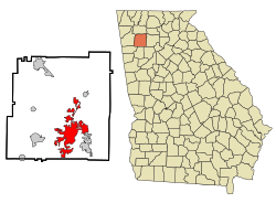
Cartersville is a city in Bartow County in the U.S. state of Georgia; it is located within the northwest edge of the Atlanta metropolitan area. As of the 2010 census, the city had a population of 19,731. Cartersville is the county seat of Bartow County.
Cartersville was first known as Birmingham to its original English settlers. The town was incorporated as Cartersville in 1854. The present name is for Col. F. Carter of Milledgeville.
Cartersville was designated the seat of Bartow County in 1867 following the destruction of Cassville by Sherman in the American Civil War. Cartersville was incorporated as a city in 1872.
Cartersville is located in south-central Bartow County, 42 miles (68 km) northwest of downtown Atlanta and 76 miles (122 km) southeast of Chattanooga, Tennessee.
The Etowah River flows through a broad valley south of the downtown, leading west to Rome, where it forms the Coosa River, a tributary of the Alabama River. The city limits extend eastward, upriver, as far as Allatoona Dam, which forms Lake Allatoona, a large U.S. Army Corps of Engineers reservoir. Red Top Mountain State Park sits on a peninsula in the lake, just outside the city limits. Nancy Creek also flows in the vicinity. The highest point in the city is 1,562 feet (476 m) at the summit of Pine Mountain.
According to the U.S. Census Bureau, Cartersville has a total area of 29.3 square miles (75.9 km2), of which 29.2 square miles (75.5 km2) is land and 0.15 square miles (0.4 km2), or 0.59%, is water.
...
Wikipedia

