Caney, Kansas
| Caney, Kansas | |
|---|---|
| City | |
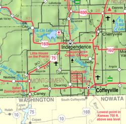
 Location within Montgomery County and Kansas |
|
 KDOT map of Montgomery County (legend) |
|
| Coordinates: 37°0′49″N 95°56′1″W / 37.01361°N 95.93361°WCoordinates: 37°0′49″N 95°56′1″W / 37.01361°N 95.93361°W | |
| Country | United States |
| State | Kansas |
| County | Montgomery |
| Area | |
| • Total | 1.35 sq mi (3.50 km2) |
| • Land | 1.35 sq mi (3.50 km2) |
| • Water | 0 sq mi (0 km2) |
| Elevation | 778 ft (237 m) |
| Population (2010) | |
| • Total | 1,966 |
| • Estimate (2015) | 2,080 |
| • Density | 1,500/sq mi (560/km2) |
| Time zone | CST (UTC-6) |
| • Summer (DST) | CDT (UTC-5) |
| ZIP code | 67333 |
| Area code | 620 |
| FIPS code | 20-10375 |
| GNIS feature ID | 0469249 |
| Website | City Website |
Caney is a city in Montgomery County, Kansas, United States. As of the 2010 census, the city population was 1,966.
Caney was founded in 1869. It was named from the Caney River. The first post office in Caney was established in May 1870.
In 1887, the railroad was built through Caney, and in that same year, the town was incorporated.
Caney has long been associated with the petroleum industry in Kansas. In 1906, a major gas well fire took place in this area. In 1909, Caney became the site of the original Kanotex Refining Company. Currently, CVR Energy's pipeline system can transport up to 145,000 barrels/day of crude oil from Caney to that company's refinery in Coffeyville, Kansas.
Caney Kansas: "A March attempt to cover the huge burning gas well six miles from here with a great iron hood upon which a week of preparation had been spent was made last night and failed. The hood with its attached pipes and weights weighing more than 35 tons was thrust aside, bent and broken by the mighty rush of gas and flames. The cap was placed partly over the stream of fire only after strenuous efforts and at great hardship to the men, the intensity from the heat slowing the effort; the gas spouted from the well with renewed force expelling rocks and shooting a flame over 150 feet into the air. Several thousand spectators drawn by the unusual spectacle came to Caney from all directions, the railways running in excursion trains. The well has now been burning for 15 days and millions of feet of gas have been burned."
Caney is located at 37°0′49″N 95°56′1″W / 37.01361°N 95.93361°W (37.013537, -95.933739). According to the United States Census Bureau, the city has a total area of 1.35 square miles (3.50 km2), all of it land.
...
Wikipedia
