Canal Fulton, Ohio
| Canal Fulton, Ohio | |
|---|---|
| City | |

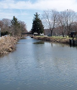
Along the Ohio and Erie Canal
|
|
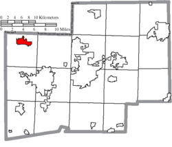
 Location of Canal Fulton, Ohio |
|
 Location of Canal Fulton in Stark County |
|
| Coordinates: 40°53′23″N 81°35′43″W / 40.88972°N 81.59528°WCoordinates: 40°53′23″N 81°35′43″W / 40.88972°N 81.59528°W | |
| Country | United States |
| State | Ohio |
| County | Stark |
| Area | |
| • Total | 3.32 sq mi (8.60 km2) |
| • Land | 3.26 sq mi (8.44 km2) |
| • Water | 0.06 sq mi (0.16 km2) |
| Elevation | 951 ft (290 m) |
| Population (2010) | |
| • Total | 5,479 |
| • Estimate (2012) | 5,484 |
| • Density | 1,680.7/sq mi (648.9/km2) |
| Time zone | Eastern (EST) (UTC-5) |
| • Summer (DST) | EDT (UTC-4) |
| ZIP code | 44614 |
| Area code(s) | 330 |
| FIPS code | 39-11304 |
| GNIS feature ID | 1060923 |
Canal Fulton is a city in Stark County in the U.S. state of Ohio. The population was 5,479 at the 2010 census. It is part of the Canton-Massillon, OH Metropolitan Statistical Area.
Canal Fulton is located at 40°53′23″N 81°35′43″W / 40.88972°N 81.59528°W (40.889806, -81.595339), along the Tuscarawas River.
According to the United States Census Bureau, the city has a total area of 3.32 square miles (8.60 km2), of which 3.26 square miles (8.44 km2) is land and 0.06 square miles (0.16 km2) is water.
Canal Fulton traces its history to three villages that developed along the Tuscarawas River. Milan was platted on March 23, 1814. Fulton was platted on May 16, 1826, changed its name to Canal Fulton in 1832, and later incorporated as a village. The present name is an amalgamation of the Ohio Canal and the name of a local pioneer, Ben Fulton. In 1853, Canal Fulton absorbed both Milan and West Fulton.
In 1997, Canal Fulton withdrew from surrounding Lawrence Township via a paper township named Milan Township, after the former village.
As of the census of 2010, there were 5,479 people, 2,186 households, and 1,488 families residing in the city. The population density was 1,680.7 inhabitants per square mile (648.9/km2). There were 2,362 housing units at an average density of 724.5 per square mile (279.7/km2). The racial makeup of the city was 97.0% White, 0.6% African American, 0.1% Native American, 0.4% Asian, 0.2% from other races, and 1.7% from two or more races. Hispanic or Latino of any race were 1.5% of the population.
...
Wikipedia
