Canadian Prairie
| Canadian Prairies Prairies canadiennes (French) |
|
| The Prairies | |
| Region | |
|
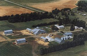
Farm on the prairies near Hartney, Manitoba
|
|
| Country | |
|---|---|
| Provinces | Alberta, Saskatchewan, Manitoba |
| Highest point | |
| - elevation | 3,747 m (12,293 ft) |
| Lowest point | |
| - elevation | 0 m (0 ft) |
| Area | 1,780,650.6 km2 (687,513 sq mi) |
| Population | 6,748,280 (2016) |
|
Map of Prairie Provinces
|
|
| Census metropolitan areas in the Canadian Prairies | |||||
|---|---|---|---|---|---|
| Rank | Census metropolitan area | Population (2011) | Population (2006) | Province | |
| 1 | Calgary | 1,214,839 | 1,079,310 | Alberta | |
| 2 | Edmonton | 1,159,869 | 1,034,945 | Alberta | |
| 3 | Winnipeg | 730,018 | 694,668 | Manitoba | |
| 4 | Saskatoon | 260,600 | 233,923 | Saskatchewan | |
| 5 | Regina | 210,556 | 194,971 | Saskatchewan | |
The Canadian Prairies is a region in western Canada, which may correspond to several different definitions, natural or political. Notably, the Prairie provinces or simply the Prairies comprise the provinces of Alberta, Saskatchewan, and Manitoba, as they are partially covered by prairie (grasslands), mostly in the southern regions of each province. In a more restricted sense, the term may also refer only to the areas of those provinces covered by prairie; their portions of the physiographic region known as the Interior Plains. Prairie also covers portions of northeastern British Columbia, though that province is typically not included in the region in a political sense.
The prairies in Canada refers to temperate grasslands and shrublands biome, within the prairie ecoregion of Canada and consists of Northern mixed grasslands in Alberta, Saskatchewan, and southern Manitoba. Northern short grasslands in southeastern Alberta and southwestern Saskatchewan. Northern tall grasslands in southern Manitoba, and Aspen parkland, which covers central Alberta, central Saskatchewan, and southern Manitoba. The Prairie starts from north of Edmonton, it covers the three provinces in a southward-slanting line east to the Manitoba-Minnesota border. Alberta has the most land classified as Prairie, while Manitoba has the least, as the Boreal Forest begins at a lower latitude in Manitoba than in Alberta.
According to the Köppen climate classification the Canadian prairies generally experience dry semi-arid climates (Köppen Bsk) in the brown soil regions, and somewhat dry Humid Continental climates (Köppen Dfb) in the outer dark brown and black soil areas. The Canadian prairies typically experience about 12 to 15 in (300 to 380 mm) of annual precipitation in the semi-arid areas while they experience 16 to 20 in (410 to 510 mm) in the continental regions. Manitoba is generally the coldest and most humid of the three prairie provinces. The area is also prone to thunderstorms in the spring and summer. Some of these storms, especially further south, are strong enough for tornadoes.
...
Wikipedia


