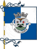
Calheta, Azores
| Calheta | |||
| Municipality (Concelho) | |||
|
Interior range of the Volcanic Complex of Topo, dividing the northern and southern parishes of the municipality of Calheta
|
|||
|
|||
| Official name: Concelho de Calheta | |||
| Name origin: Portuguese for small harbour | |||
| Country | |||
|---|---|---|---|
| Autonomous Region | |||
| Island | São Jorge | ||
| Civil Parishes | Calheta, Norte Pequeno, Ribeira Seca, Santo Antão, Topo | ||
| Center | Calheta | ||
| - elevation | 22 m (72 ft) | ||
| - coordinates | 38°36′5″N 28°0′46″W / 38.60139°N 28.01278°WCoordinates: 38°36′5″N 28°0′46″W / 38.60139°N 28.01278°W | ||
| Highest point | Pico dos Frades | ||
| - elevation | 946 m (3,104 ft) | ||
| - coordinates | 38°35′2″N 27°53′28″W / 38.58389°N 27.89111°W | ||
| Lowest point | Sea level | ||
| - location | Atlantic Ocean | ||
| - elevation | 0 m (0 ft) | ||
| Area | 126.26 km2 (49 sq mi) | ||
| - water | .10 km2 (0 sq mi) | ||
| - urban | 4.06 km2 (2 sq mi) | ||
| Population | 3,773 (2011) | ||
| Density | 30/km2 (78/sq mi) | ||
| Settlement | c. 1483 | ||
| - Municipality | c. 1534 | ||
| LAU | Câmara Municipal | ||
| - location | Rua 25 de Abril | ||
| President | Duarte Manuel de Bettencourt da Silveira (PPD-PSD) | ||
| Timezone | Azores (UTC-1) | ||
| - summer (DST) | Azores (UTC0) | ||
| Postal Zone | 9850-032 | ||
| Area Code & Prefix | (+351) 292 XXX-XXXX | ||
| Demonym | Calhetense | ||
| Patron Saint | Santa Catarina de Alexandria | ||
| Municipal Holidays | 25 November | ||
|
Location of the municipality of Calheta in the archipelago of the Azores
|
|||
| Website: www.cm-calheta.pt | |||
Calheta (Portuguese pronunciation: [kɐˈʎetɐ]) is a municipality on the island of São Jorge, in the Portuguese autonomous region of Azores. The municipality includes the eastern portion of the island of São Jorge and borders the municipality of Velas. The population in 2011 was 3,773, in an area of 126.26 km².
The first reference to São Jorge was in 1439, but it wasn't until 1470, when colonial nuclei dotted the southern and western coast: the first of these colonists were believed to have come from northern Europe. The municipality of Calheta, whose first settlers arrived around the 1480s (principally in the area of Topo, but later into the sheltered coves and fajãs) along the southern coast of the island). The island of São Jorge was ceded to João Vaz Corte-Real on 4 May 1483, becoming the first Captain-Donatario, thus initiating the primary settlement of the island. This phase of development is notable for the settlement of Willem van der Haegen, a Flemish pioneer of Azorean colonization who traveled and settled in Faial, Corvo and Terceira). His final resting place was in the settlement of Topo, which he founded with other Flemish settlers; he died in 1500, and was buried in the chapel-annex to the Solar dos Tiagos. Topo was later elevated to municipality and its village the municipal seat, on 12 September 1510.
Calheta was elevated to the status of town on 3 June 1534 by regal decree, issued by King D. John III.
Meanwhile, other settlements developed rapidly due to a number of sheltered anchorages and the fertility of the small fajãs where colonists established homes. Fajã de São João, one of this settlements along the southern coast, had settlers as early as 1550 (this is conjecture established from the Chapel of São João. In Topo, the community established a port in order to establish trade with Terceira (at that time the largest municipal and commercial center in the Azores). Other settlements radiated from the coastal beachheads and the growth of the number of colonists justified the de-annexation of the parish of Calheta from the municipality of Velas. Demonstrating an economic vitality (based on its vineyards, cereal crops, yams and the exploration of lichen roccella which was being exported to Flanders for use in the dye industry), it was elevated to the status of {{pt:Vila}} on 3 June 1534, by decree of King John III of Portugal.
...
Wikipedia


