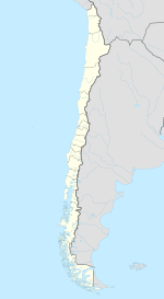
Calama, Chile
| Calama | ||||||
|---|---|---|---|---|---|---|
| City and Commune | ||||||
|
||||||
| Coordinates (city): 22°28′S 68°56′W / 22.467°S 68.933°WCoordinates: 22°28′S 68°56′W / 22.467°S 68.933°W | ||||||
| Country |
|
|||||
| Region |
|
|||||
| Province | El Loa | |||||
| Government | ||||||
| • Type | Municipality | |||||
| • Alcalde | Esteban Velásquez Núñez | |||||
| Area | ||||||
| • Total | 15,596.9 km2 (6,022.0 sq mi) | |||||
| Elevation | 2,260 m (7,410 ft) | |||||
| Population (2012) | ||||||
| • Total | 147,886 | |||||
| • Density | 9.5/km2 (25/sq mi) | |||||
| • Urban | 136,600 | |||||
| • Rural | 1,802 | |||||
| Demonym(s) | Calamenian | |||||
| Sex | ||||||
| • Male | 70,832 | |||||
| • Female | 67,570 | |||||
| Time zone | CLT (UTC−4) | |||||
| • Summer (DST) | CLST (UTC−3) | |||||
| Postal code | 1399001 | |||||
| Climate | BWk | |||||
| Website | Official website (Spanish) | |||||
Calama is a city and commune in the Atacama Desert in northern Chile. It is the capital of El Loa Province, part of the Antofagasta Region. Calama is one of the driest cities in the world with average annual precipitation of just 5 mm (0.20 in). The River Loa, Chile's longest, flows through the city. Calama has a population of 147,886 (2012 census).
The commune also encompasses the Quechuas communities of Estación San Pedro, and Cupo; and the Lickan-antay communities of Taira, Conchi Viejo, Lasana, San Francisco de Chiu Chiu, Aiquina-Turi, and Caspana.
At an elevation of 2,260 m (7,400 ft), Calama is the gateway to the geological and archaeological wonders of Chile’s high central desert. Some of these places of interest include: the town of Chuquicamata, the village of San Pedro de Atacama, Valle de la Luna (Valley of the Moon), the Licancabur volcano, R. P. Gustavo Le Paige Archaeological Museum, Los Flamencos National Reserve, the Aguas Calientes Salt Flat, the Tuyajto lagoon, the El Tatio Geysers, the village of Chiu-Chiu.
...
Wikipedia


