Cairo (town), New York
| Cairo, New York | |
|---|---|
| Town | |
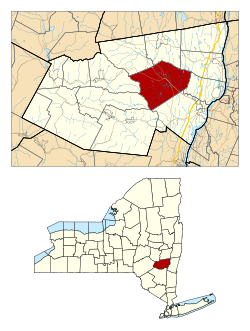
 Location in Greene County and the state of New York |
|
| Coordinates: 42°18′08″N 73°59′44″W / 42.30222°N 73.99556°WCoordinates: 42°18′08″N 73°59′44″W / 42.30222°N 73.99556°W | |
| Country | United States |
| State | New York |
| County | Greene |
| Established | 1803 |
| Government | |
| • Type | Town Council |
| • Town Supervisor | Daniel Benoit (R) |
| • Town Council |
Members
|
| Area | |
| • Total | 60.08 sq mi (155.61 km2) |
| • Land | 59.83 sq mi (154.95 km2) |
| • Water | 0.25 sq mi (0.66 km2) |
| Population (2010) | |
| • Total | 6,670 |
| • Estimate (2016) | 6,454 |
| • Density | 107.88/sq mi (41.65/km2) |
| Time zone | EST (UTC-5) |
| • Summer (DST) | EDT (UTC-4) |
| FIPS code | 36-039-11649 |
Cairo /ˈkɛəroʊ/ is a town in Greene County, New York, United States. The population was 6,610 at the 2010 census. The town is in the south part of the county, partly in the Catskill Park. The town contains a hamlet also named Cairo.
The first settler arrived around 1772, but many new families moved in after the American Revolution. In 1803, the town of Cairo was formed from the towns of Catskill, Coxsackie, and Durham. Formerly known as "Canton", the town's name was changed in 1808 to "Cairo". The accepted pronunciation is "care-oh", and newcomers are quickly advised of this.
From 1800 the Susquehannah Turnpike, a private toll road, ran through the town. The only railroad, the Canajoharie and Catskill Railroad, ran through the town, but only operated from about 1839 to 1842.
According to the United States Census Bureau, the town has a total area of 60.1 square miles (155.8 km²), of which 60.0 square miles (155.3 km²) is land and 0.2 square miles (0.4 km², or 0.27%) is water.
Catskill Creek flows through the town.
As of the census of 2000, there were 6,355 people, 2,579 households, and 1,709 families residing in the town. The population density was 106.0 people per square mile (40.9/km²). There were 3,322 housing units at an average density of 55.4 per square mile (21.4/km²). The racial makeup of the town was 96.87% White, 0.55% Black or African American, 0.33% Native American, 0.22% Asian, 0.60% from other races, and 1.43% from two or more races. Hispanic or Latino of any race were 3.67% of the population.
...
Wikipedia
