Cafer Höyük
| Alternate name | Cafer Hoyuk |
|---|---|
| Coordinates | 38°25′00″N 38°45′00″E / 38.4166°N 38.75°E |
| Type | Tell |
| History | |
| Founded | 8920 - 7110 BCE |
| Cultures | Paleolithic, PPNB, Neolithic, Bronze Age, Medieval |
| Site notes | |
| Excavation dates | 1979-1986 |
| Archaeologists | Jacques Cauvin |
| Public access | yes |
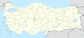
Cafer Hoyuk or Cafer Höyük is an archaeological site located around 40 kilometres (25 mi) northeast of Malatya, Turkey in the Euphrates valley. It was inhabited over ten thousand years ago during the Neolithic revolution.
Construction of the Karakaya Dam has flooded the northeast of the tell mound. Rescue excavations were carried out by the French National Scientific Research Centre (CNRS) under Jacques Cauvin between 1979 and 1986. Finds at the site were dated to the Paleolithic, Pre-Pottery Neolithic, Pottery Neolithic, Early Bronze Age along with a few Medieval finds. Building techniques at the site were seen to be similar to those used at Cayonu with a rectangular mud-brick structures with three rooms called by Cauvin the "cell-plan" phase. Engravings of the shoulders of bulls on the walls of a house were indicative of animalism similar to that found at Catal Hoyuk. The first evidence of domesticated cereals appears shortly before this stage. farming was not evidenced at this level but developed later in the PPNB. Features of the tell mound have been suggested to indicate male and female fertility features. Votive figurines were also found during excavations that were suggested to be male Gods.
...
Wikipedia

