Cabool, Missouri
| Cabool, Missouri | |
|---|---|
| City | |

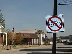
Main street, Cabool
|
|
 Location of Cabool, Missouri |
|
| Coordinates: 37°7′34″N 92°6′13″W / 37.12611°N 92.10361°WCoordinates: 37°7′34″N 92°6′13″W / 37.12611°N 92.10361°W | |
| Country | United States |
| State | Missouri |
| County | Texas |
| Area | |
| • Total | 3.90 sq mi (10.10 km2) |
| • Land | 3.84 sq mi (9.95 km2) |
| • Water | 0.06 sq mi (0.16 km2) |
| Elevation | 1,283 ft (391 m) |
| Population (2010) | |
| • Total | 2,146 |
| • Estimate (2012) | 2,132 |
| • Density | 558.9/sq mi (215.8/km2) |
| Time zone | Central (CST) (UTC-6) |
| • Summer (DST) | CDT (UTC-5) |
| FIPS code | 29-10288 |
| GNIS feature ID | 0749152 |
Cabool is a city in Texas County, Missouri, United States. The population was 2,146 at the 2010 census.
According to the United States Census Bureau, the city has a total area of 3.90 square miles (10.10 km2), of which, 3.84 square miles (9.95 km2) is land and 0.06 square miles (0.16 km2) is water.
The city was named after Kabul, Afghanistan, using an older English spelling of the name, in 1882. The British had just pulled out of Kabul at the end of the Second Anglo-Afghan War in 1881. As local legend goes, one of the construction engineers who built the railroad through Cabool also worked on railroad construction in Afghanistan and thought this area of southern Texas County looked similar to the region of Kabul, Afghanistan. Prior to being called Cabool, the community was known as Cedar Bluff. It remains the only "Cabool" in the United States of America.
Old Legends claim that Cabool was named after the Indian chief that lived there, whose name was "Chief Kabul" (pronounced Kay-Bull). The legend says Chief Kabul and his sweetheart jumped ( into the "onyx pool" ) together to their deaths off Cedar Bluff at Cabool, as their parents disapproved of their relationship. This legend was depicted in the 1903 poem Legend of Cabool written by Tug Wilson and Ben Durnell. The yearbook at Cabool Schools is still known as the "Kabul", named for Chief Kabul.
Historically, Texas County consistently voted Democratic in elections. Recently Texas county has voted mostly for Republicans.
In 2000, Cabool was the largest city in the largest geographic county (Texas County) in Missouri. The school district is the home of the "Bulldogs". Cabool High School is a historic native rock structure with the oldest buildings being constructed in 1932. At least one of the buildings on the high school campus was a project of the federal Works Projects Administration (WPA).
As of the census of 2010, there were 2,146 people, 918 households, and 515 families residing in the city. The population density was 558.9 inhabitants per square mile (215.8/km2). There were 1,054 housing units at an average density of 274.5 per square mile (106.0/km2). The racial makeup of the city was 96.4% White, 0.4% African American, 0.5% Native American, 0.6% Asian, 0.1% from other races, and 2.1% from two or more races. Hispanic or Latino of any race were 2.6% of the population.
...
Wikipedia
